Rustāq geodata
Rustāq (Takhar) is a seat of a second-order administrative division; located in Afghanistan in Asia/Kabul (GMT+4.5) time zone. With population of 25,636 people, there are 32 cities with bigger population in this country. Compared to other cities in Afghanistan, 94.5% of cities are located further ↓South; 80.1% of cities are located further ←West and 51.8% of cities have higher elevation than Rustāq. Note1


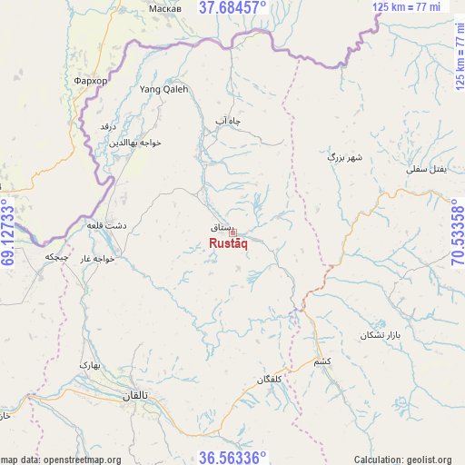
Rustāq GPS coordinates[2]
37° 7' 33.744" North, 69° 49' 49.62" East
| Map corner | latitude | longitude |
|---|---|---|
| Upper-left | 37.68457°, | 69.12733° |
| Center: | 37.12604°, | 69.83045° |
| Lower-right: | 36.56336°, | 70.53358° |
| Map W x H: | 124.7×124.7 km | = 77.5×77.5mi |
| max Lat: | 38.4435° ⇑5.5% North |
| Rustāq: | 37.12604° |
| min Lat: | ⇓94.5% South 30.15° |
| min Long | Rustāq | max Long |
| 61.06667° | 69.83045° | 72.318° |
| W 80.1%⇐ | ⇒19.9% E |
Elevation
Elevation of Rustāq is 1314 m = 4311 ft, and this is 104.4 m = 343 ft below average elevation for this country.
| Max E: |
3068 m = 10066 ft | 51.8% |
| Avg. | 1418.4 m = 4654 ft | |
| Rustāq | 1314 m = 4311 ft | |
Min E: |
254 m = 833 ft | 48.2% |
See also: Afghanistan elevation on elevation.city.
Geographical zone
Rustāq is located in North temperate zone (between Tropic of Cancer and the Arctic Circle). Distance of this Northern Tropic circle is 1522.1 km =945.8 mi to South.| Distance of | km | miles | from Rustāq |
|---|---|---|---|
| North Pole | 5879 | 3653 | to North |
| Arctic Circle | 3273.1 | 2033.8 | to North |
| Tropic Cancer | 1522.1 | 945.8 | to South |
| Equator | 4128 | 2565 | to South |


Nearby cities:
15 places around Rustāq: (largest is in red/bold)
• Bāzār-e Tashkān
48 km =29.8 mi,  124°
124°
• Chāh Āb
30.2 km =18.8 mi,  357°
357°
• Darqad
44 km =27.3 mi,  310°
310°
• Darāyim
56.9 km =35.4 mi, 120°
• Dasht-e Archī
58.8 km =36.5 mi,  270°
270°
• Dasht-e Qal‘ah
34.4 km =21.4 mi,  275°
275°
• Kalafgān
40.6 km =25.2 mi,  165°
165°
• Khwājah Ghār
36.9 km =22.9 mi,  259°
259°
• Khānaqāh
61.4 km =38.2 mi,  205°
205°
• Mashhad
42 km =26.1 mi,  144°
144°
• Taloqan
50.7 km =31.5 mi, 211°
• Yangī Qal‘ah
42.5 km =26.4 mi,  332°
332°
• Ārt Khwājah
31.4 km =19.5 mi, 261°
• Ţāqchah Khānah
59.2 km =36.8 mi,  197°
197°
• Ḩāfiz̧ Moghul
51.2 km =31.8 mi,  98°
98°
Sources, notices
• [Note1] Compared only with cities in Afghanistan existing in our database
• [Src1] Map data: © OpenStreetMap contributors (CC-BY-SA)
• [Src2] Other city data from geonames.org with taken over terms of usage.
• [Src3] Geographical zone / Annual Mean Temperature by Robert A. Rohde @ Wikipedia
