Kalafgān geodata
Kalafgān (Takhar) is a seat of a second-order administrative division; located in Afghanistan in Asia/Kabul (GMT+4.5) time zone. In our database, there are 93 cities with bigger population. Compared to other cities in Afghanistan, 86.5% of cities are located further ↓South; 81.7% of cities are located further ←West and 58.5% of cities have lower elevation than Kalafgān. Note1


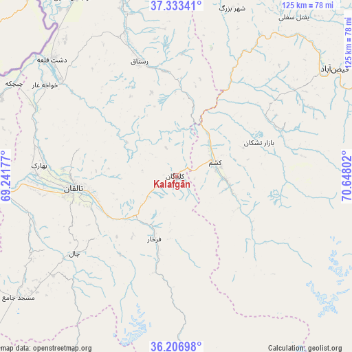
Kalafgān GPS coordinates[2]
36° 46' 20.136" North, 69° 56' 41.604" East
| Map corner | latitude | longitude |
|---|---|---|
| Upper-left | 37.33341°, | 69.24177° |
| Center: | 36.77226°, | 69.94489° |
| Lower-right: | 36.20698°, | 70.64802° |
| Map W x H: | 125.2×125.2 km | = 77.8×77.8mi |
| max Lat: | 38.4435° ⇑13.5% North |
| Kalafgān: | 36.77226° |
| min Lat: | ⇓86.5% South 30.15° |
| min Long | Kalafgān | max Long |
| 61.06667° | 69.94489° | 72.318° |
| W 81.7%⇐ | ⇒18.3% E |
Elevation
Elevation of Kalafgān is 1590 m = 5217 ft, and this is 171.6 m = 563 ft above average elevation for this country.
| Max E: |
3068 m = 10066 ft | 41.5% |
| Kalafgān | 1590 m 5217 ft | |
| Avg. | 1418.4 m = 4654 ft | |
Min E: |
254 m = 833 ft | 58.5% |
See also: Afghanistan elevation on elevation.city.
Geographical zone
Kalafgān is located in North temperate zone (between Tropic of Cancer and the Arctic Circle). Distance of this Northern Tropic circle is 1482.8 km =921.4 mi to South.| Distance of | km | miles | from Kalafgān |
|---|---|---|---|
| North Pole | 5918.4 | 3677.5 | to North |
| Arctic Circle | 3312.5 | 2058.3 | to North |
| Tropic Cancer | 1482.8 | 921.4 | to South |
| Equator | 4088.7 | 2540.6 | to South |


Nearby cities:
15 places around Kalafgān: (largest is in red/bold)
• Afaki
54.3 km =33.7 mi,  256°
256°
• Bāzār-e Tashkān
31.9 km =19.8 mi,  67°
67°
• Chāh Āb
70.5 km =43.8 mi,  350°
350°
• Darāyim
40.4 km =25.1 mi, 74°
• Dasht-e Qal‘ah
61.5 km =38.2 mi,  313°
313°
• Farkhār
23.5 km =14.6 mi,  199°
199°
• Fayzabad
68.2 km =42.4 mi,  55°
55°
• Khwājah Ghār
56.9 km =35.4 mi, 305°
• Khānaqāh
39.8 km =24.7 mi,  245°
245°
• Mashhad
14.8 km =9.2 mi, 70°
• Rustāq
40.6 km =25.2 mi, 345°
• Taloqan
36.8 km =22.9 mi, 263°
• Ārt Khwājah
54.1 km =33.6 mi, 310°
• Ţāqchah Khānah
33 km =20.5 mi,  238°
238°
• Ḩāfiz̧ Moghul
51.4 km =31.9 mi,  52°
52°
Sources, notices
• [Note1] Compared only with cities in Afghanistan existing in our database
• [Src1] Map data: © OpenStreetMap contributors (CC-BY-SA)
• [Src2] Other city data from geonames.org with taken over terms of usage.
• [Src3] Geographical zone / Annual Mean Temperature by Robert A. Rohde @ Wikipedia
