Taloqan geodata
Taloqan (Takhar) is a seat of a first-order administrative division; located in Afghanistan in Asia/Kabul (GMT+4.5) time zone. With population of 64,256 people, there are 15 cities with bigger population in this country. Compared to other cities in Afghanistan, 85.9% of cities are located further ↓South; 74.6% of cities are located further ←West and 75.9% of cities have higher elevation than Taloqan. Note1


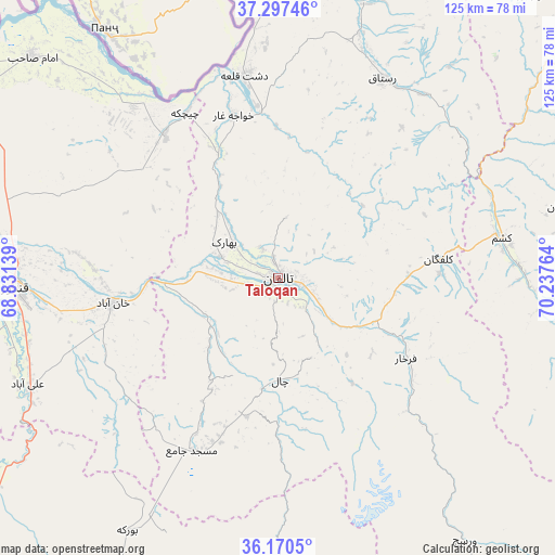
Taloqan GPS coordinates[2]
36° 44' 9.78" North, 69° 32' 4.236" East
| Map corner | latitude | longitude |
|---|---|---|
| Upper-left | 37.29746°, | 68.83139° |
| Center: | 36.73605°, | 69.53451° |
| Lower-right: | 36.1705°, | 70.23764° |
| Map W x H: | 125.3×125.3 km | = 77.9×77.9mi |
| max Lat: | 38.4435° ⇑14.1% North |
| Taloqan: | 36.73605° |
| min Lat: | ⇓85.9% South 30.15° |
| min Long | Taloqan | max Long |
| 61.06667° | 69.53451° | 72.318° |
| W 74.6%⇐ | ⇒25.4% E |
Elevation
Elevation of Taloqan is 801 m = 2628 ft, and this is 617.4 m = 2026 ft below average elevation for this country.
| Max E: |
3068 m = 10066 ft | 75.9% |
| Avg. | 1418.4 m = 4654 ft | |
| Taloqan | 801 m = 2628 ft | |
Min E: |
254 m = 833 ft | 24.1% |
See also: Taloqan elevation on elevation.city.
Geographical zone
Taloqan is located in North temperate zone (between Tropic of Cancer and the Arctic Circle). Distance of this Northern Tropic circle is 1478.7 km =918.8 mi to South.| Distance of | km | miles | from Taloqan |
|---|---|---|---|
| North Pole | 5922.4 | 3680 | to North |
| Arctic Circle | 3316.5 | 2060.8 | to North |
| Tropic Cancer | 1478.7 | 918.8 | to South |
| Equator | 4084.7 | 2538.1 | to South |


Nearby cities:
15 places around Taloqan: (largest is in red/bold)
• Afaki
18.3 km =11.4 mi,  243°
243°
• Aliabad
61.5 km =38.2 mi,  247°
247°
• Dasht-e Archī
55 km =34.2 mi,  323°
323°
• Dasht-e Qal‘ah
47.2 km =29.3 mi,  350°
350°
• Dowr-e Rabāţ
66.5 km =41.3 mi,  265°
265°
• Farkhār
34.1 km =21.2 mi,  122°
122°
• Kalafgān
36.8 km =22.9 mi,  83°
83°
• Khanabad
37.8 km =23.5 mi,  260°
260°
• Khwājah Ghār
38 km =23.6 mi,  344°
344°
• Khānaqāh
12.3 km =7.6 mi,  178°
178°
• Kunduz
60.4 km =37.5 mi, 269°
• Mashhad
51.3 km =31.9 mi, 79°
• Rustāq
50.7 km =31.5 mi,  31°
31°
• Ārt Khwājah
39.2 km =24.4 mi, 352°
• Ţāqchah Khānah
15.4 km =9.6 mi,  147°
147°
Sources, notices
• [Note1] Compared only with cities in Afghanistan existing in our database
• [Src1] Map data: © OpenStreetMap contributors (CC-BY-SA)
• [Src2] Other city data from geonames.org with taken over terms of usage.
• [Src3] Geographical zone / Annual Mean Temperature by Robert A. Rohde @ Wikipedia
