Bāzār-e Tashkān geodata
Bāzār-e Tashkān (Badakhshan) is a seat of a second-order administrative division; located in Afghanistan in Asia/Kabul (GMT+4.5) time zone. In our database, there are 93 cities with bigger population. Compared to other cities in Afghanistan, 89.1% of cities are located further ↓South; 85.5% of cities are located further ←West and 53.1% of cities have higher elevation than Bāzār-e Tashkān. Note1


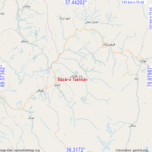
Bāzār-e Tashkān GPS coordinates[2]
36° 52' 54.048" North, 70° 16' 36.264" East
| Map corner | latitude | longitude |
|---|---|---|
| Upper-left | 37.44202°, | 69.57362° |
| Center: | 36.88168°, | 70.27674° |
| Lower-right: | 36.3172°, | 70.97987° |
| Map W x H: | 125.1×125.1 km | = 77.7×77.7mi |
| max Lat: | 38.4435° ⇑10.9% North |
| Bāzār-e Tashkān: | 36.88168° |
| min Lat: | ⇓89.1% South 30.15° |
| min Long | Bāzār-e Tashk | max Long |
| 61.06667° | 70.27674° | 72.318° |
| W 85.5%⇐ | ⇒14.5% E |
Elevation
Elevation of Bāzār-e Tashkān is 1285 m = 4216 ft, and this is 133.4 m = 438 ft below average elevation for this country.
| Max E: |
3068 m = 10066 ft | 53.1% |
| Avg. | 1418.4 m = 4654 ft | |
| Bāzār-e Tashkān | 1285 m = 4216 ft | |
Min E: |
254 m = 833 ft | 46.9% |
See also: Afghanistan elevation on elevation.city.
Geographical zone
Bāzār-e Tashkān is located in North temperate zone (between Tropic of Cancer and the Arctic Circle). Distance of this Northern Tropic circle is 1494.9 km =928.9 mi to South.| Distance of | km | miles | from Bāzār-e Tashkān |
|---|---|---|---|
| North Pole | 5906.2 | 3669.9 | to North |
| Arctic Circle | 3300.3 | 2050.7 | to North |
| Tropic Cancer | 1494.9 | 928.9 | to South |
| Equator | 4100.9 | 2548.2 | to South |


Nearby cities:
15 places around Bāzār-e Tashkān: (largest is in red/bold)
• Bahārak
57.6 km =35.8 mi,  76°
76°
• Chāh Āb
70.5 km =43.8 mi,  324°
324°
• Chākarān
70.5 km =43.8 mi,  87°
87°
• Darāyim
9.6 km =6 mi,  99°
99°
• Farkhār
50.7 km =31.5 mi,  227°
227°
• Fayzabad
37.5 km =23.3 mi,  45°
45°
• Ghurayd Gharamē
60.8 km =37.8 mi,  131°
131°
• Jurm
49.6 km =30.8 mi, 92°
• Kalafgān
31.9 km =19.8 mi,  247°
247°
• Mashhad
17.1 km =10.6 mi, 245°
• Rustāq
48 km =29.8 mi,  304°
304°
• Shahrān
42.5 km =26.4 mi, 75°
• Taloqan
68 km =42.3 mi,  256°
256°
• Ţāqchah Khānah
64.7 km =40.2 mi,  243°
243°
• Ḩāfiz̧ Moghul
22.3 km =13.9 mi,  29°
29°
Sources, notices
• [Note1] Compared only with cities in Afghanistan existing in our database
• [Src1] Map data: © OpenStreetMap contributors (CC-BY-SA)
• [Src2] Other city data from geonames.org with taken over terms of usage.
• [Src3] Geographical zone / Annual Mean Temperature by Robert A. Rohde @ Wikipedia
