Khānaqāh geodata
Khānaqāh (Takhar) is a seat of a second-order administrative division; located in Afghanistan in Asia/Kabul (GMT+4.5) time zone. In our database, there are 93 cities with bigger population. Compared to other cities in Afghanistan, 82.3% of cities are located further ↓South; 74.9% of cities are located further ←West and 50.8% of cities have lower elevation than Khānaqāh. Note1


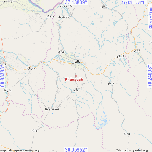
Khānaqāh GPS coordinates[2]
36° 37' 33.132" North, 69° 32' 13.02" East
| Map corner | latitude | longitude |
|---|---|---|
| Upper-left | 37.18809°, | 68.83383° |
| Center: | 36.62587°, | 69.53695° |
| Lower-right: | 36.05952°, | 70.24008° |
| Map W x H: | 125.5×125.5 km | = 78×78mi |
| max Lat: | 38.4435° ⇑17.7% North |
| Khānaqāh: | 36.62587° |
| min Lat: | ⇓82.3% South 30.15° |
| min Long | Khānaqāh | max Long |
| 61.06667° | 69.53695° | 72.318° |
| W 74.9%⇐ | ⇒25.1% E |
Elevation
Elevation of Khānaqāh is 1378 m = 4521 ft, and this is 40.4 m = 133 ft below average elevation for this country.
| Max E: |
3068 m = 10066 ft | 49.2% |
| Avg. | 1418.4 m = 4654 ft | |
| Khānaqāh | 1378 m = 4521 ft | |
Min E: |
254 m = 833 ft | 50.8% |
See also: Afghanistan elevation on elevation.city.
Geographical zone
Khānaqāh is located in North temperate zone (between Tropic of Cancer and the Arctic Circle). Distance of this Northern Tropic circle is 1466.5 km =911.2 mi to South.| Distance of | km | miles | from Khānaqāh |
|---|---|---|---|
| North Pole | 5934.6 | 3687.6 | to North |
| Arctic Circle | 3328.8 | 2068.4 | to North |
| Tropic Cancer | 1466.5 | 911.2 | to South |
| Equator | 4072.4 | 2530.5 | to South |


Nearby cities:
15 places around Khānaqāh: (largest is in red/bold)
• Afaki
17.1 km =10.6 mi,  283°
283°
• Aliabad
58.1 km =36.1 mi,  258°
258°
• Būrkah
56.6 km =35.2 mi,  217°
217°
• Dasht-e Archī
65.3 km =40.6 mi,  329°
329°
• Dasht-e Qal‘ah
59.3 km =36.8 mi,  351°
351°
• Farkhār
29.2 km =18.1 mi,  101°
101°
• Kalafgān
39.8 km =24.7 mi,  65°
65°
• Khanabad
38.1 km =23.7 mi, 279°
• Khwājah Ghār
50 km =31.1 mi, 348°
• Kunduz
61.7 km =38.3 mi, 280°
• Mashhad
54.7 km =34 mi, 67°
• Rustāq
61.4 km =38.2 mi,  25°
25°
• Taloqan
12.3 km =7.6 mi,  358°
358°
• Ārt Khwājah
51.4 km =31.9 mi, 354°
• Ţāqchah Khānah
8.2 km =5.1 mi, 95°
Sources, notices
• [Note1] Compared only with cities in Afghanistan existing in our database
• [Src1] Map data: © OpenStreetMap contributors (CC-BY-SA)
• [Src2] Other city data from geonames.org with taken over terms of usage.
• [Src3] Geographical zone / Annual Mean Temperature by Robert A. Rohde @ Wikipedia
