Darāyim geodata
Darāyim (Badakhshan) is a seat of a second-order administrative division; located in Afghanistan in Asia/Kabul (GMT+4.5) time zone. In our database, there are 93 cities with bigger population. Compared to other cities in Afghanistan, 88.7% of cities are located further ↓South; 87.1% of cities are located further ←West and 62.1% of cities have lower elevation than Darāyim. Note1


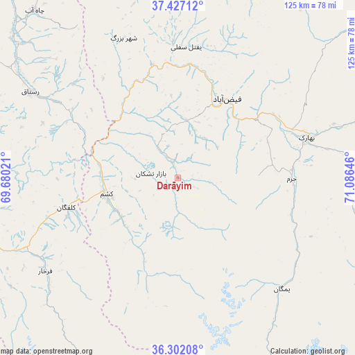
Darāyim GPS coordinates[2]
36° 52' 0.012" North, 70° 22' 59.988" East
| Map corner | latitude | longitude |
|---|---|---|
| Upper-left | 37.42712°, | 69.68021° |
| Center: | 36.86667°, | 70.38333° |
| Lower-right: | 36.30208°, | 71.08646° |
| Map W x H: | 125.1×125.1 km | = 77.7×77.7mi |
| max Lat: | 38.4435° ⇑11.3% North |
| Darāyim: | 36.86667° |
| min Lat: | ⇓88.7% South 30.15° |
| min Long | Darāyim | max Long |
| 61.06667° | 70.38333° | 72.318° |
| W 87.1%⇐ | ⇒12.9% E |
Elevation
Elevation of Darāyim is 1693 m = 5554 ft, and this is 274.6 m = 901 ft above average elevation for this country.
| Max E: |
3068 m = 10066 ft | 37.9% |
| Darāyim | 1693 m 5554 ft | |
| Avg. | 1418.4 m = 4654 ft | |
Min E: |
254 m = 833 ft | 62.1% |
See also: Afghanistan elevation on elevation.city.
Geographical zone
Darāyim is located in North temperate zone (between Tropic of Cancer and the Arctic Circle). Distance of this Northern Tropic circle is 1493.3 km =927.9 mi to South.| Distance of | km | miles | from Darāyim |
|---|---|---|---|
| North Pole | 5907.9 | 3671 | to North |
| Arctic Circle | 3302 | 2051.8 | to North |
| Tropic Cancer | 1493.3 | 927.9 | to South |
| Equator | 4099.2 | 2547.1 | to South |


Nearby cities:
15 places around Darāyim: (largest is in red/bold)
• Bahārak
48.9 km =30.4 mi,  72°
72°
• Bāzār-e Tashkān
9.6 km =6 mi,  279°
279°
• Chākarān
61.2 km =38 mi,  85°
85°
• Farkhār
57.1 km =35.5 mi,  235°
235°
• Fayzabad
32.8 km =20.4 mi,  32°
32°
• Ghurayd Gharamē
52.8 km =32.8 mi,  136°
136°
• Jurm
40.1 km =24.9 mi, 90°
• Kalafgān
40.4 km =25.1 mi,  254°
254°
• March
73.8 km =45.9 mi,  4°
4°
• Mashhad
25.6 km =15.9 mi,  257°
257°
• Pas Pul
70.6 km =43.9 mi,  16°
16°
• Rustāq
56.9 km =35.4 mi,  300°
300°
• Shahrān
34.1 km =21.2 mi, 68°
• Ţāqchah Khānah
72.7 km =45.2 mi, 247°
• Ḩāfiz̧ Moghul
21.2 km =13.2 mi, 4°
Sources, notices
• [Note1] Compared only with cities in Afghanistan existing in our database
• [Src1] Map data: © OpenStreetMap contributors (CC-BY-SA)
• [Src2] Other city data from geonames.org with taken over terms of usage.
• [Src3] Geographical zone / Annual Mean Temperature by Robert A. Rohde @ Wikipedia
