Ţāqchah Khānah geodata
Ţāqchah Khānah (Takhar) is a seat of a second-order administrative division; located in Afghanistan in Asia/Kabul (GMT+4.5) time zone. In our database, there are 93 cities with bigger population. Compared to other cities in Afghanistan, 82% of cities are located further ↓South; 76.2% of cities are located further ←West and 63.3% of cities have higher elevation than Ţāqchah Khānah. Note1


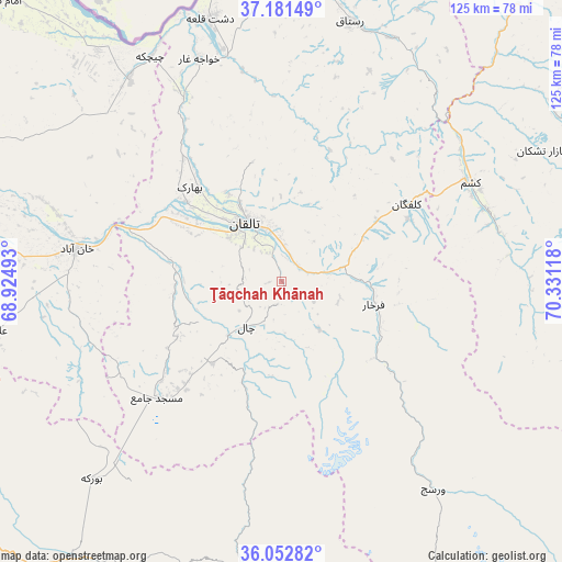
Ţāqchah Khānah GPS coordinates[2]
36° 37' 9.192" North, 69° 37' 40.98" East
| Map corner | latitude | longitude |
|---|---|---|
| Upper-left | 37.18149°, | 68.92493° |
| Center: | 36.61922°, | 69.62805° |
| Lower-right: | 36.05282°, | 70.33118° |
| Map W x H: | 125.5×125.5 km | = 78×78mi |
| max Lat: | 38.4435° ⇑18% North |
| Ţāqchah Khānah: | 36.61922° |
| min Lat: | ⇓82% South 30.15° |
| min Long | Ţāqchah Khān | max Long |
| 61.06667° | 69.62805° | 72.318° |
| W 76.2%⇐ | ⇒23.8% E |
Elevation
Elevation of Ţāqchah Khānah is 1071 m = 3514 ft, and this is 347.4 m = 1140 ft below average elevation for this country.
| Max E: |
3068 m = 10066 ft | 63.3% |
| Avg. | 1418.4 m = 4654 ft | |
| Ţāqchah Khānah | 1071 m = 3514 ft | |
Min E: |
254 m = 833 ft | 36.7% |
See also: Afghanistan elevation on elevation.city.
Geographical zone
Ţāqchah Khānah is located in North temperate zone (between Tropic of Cancer and the Arctic Circle). Distance of this Northern Tropic circle is 1465.8 km =910.8 mi to South.| Distance of | km | miles | from Ţāqchah Khānah |
|---|---|---|---|
| North Pole | 5935.4 | 3688.1 | to North |
| Arctic Circle | 3329.5 | 2068.9 | to North |
| Tropic Cancer | 1465.8 | 910.8 | to South |
| Equator | 4071.7 | 2530 | to South |


Nearby cities:
15 places around Ţāqchah Khānah: (largest is in red/bold)
• Afaki
25.2 km =15.7 mi,  280°
280°
• Aliabad
65.9 km =40.9 mi,  260°
260°
• Bāzār-e Tashkān
64.7 km =40.2 mi,  63°
63°
• Būrkah
61.4 km =38.2 mi,  224°
224°
• Dasht-e Qal‘ah
61.7 km =38.3 mi,  344°
344°
• Farkhār
21.1 km =13.1 mi,  104°
104°
• Kalafgān
33 km =20.5 mi, 58°
• Khanabad
46.3 km =28.8 mi, 278°
• Khwājah Ghār
53 km =32.9 mi, 339°
• Khānaqāh
8.2 km =5.1 mi, 275°
• Kunduz
69.8 km =43.4 mi, 280°
• Mashhad
47.6 km =29.6 mi, 62°
• Rustāq
59.2 km =36.8 mi,  17°
17°
• Taloqan
15.4 km =9.6 mi,  327°
327°
• Ārt Khwājah
53.5 km =33.2 mi,  345°
345°
Sources, notices
• [Note1] Compared only with cities in Afghanistan existing in our database
• [Src1] Map data: © OpenStreetMap contributors (CC-BY-SA)
• [Src2] Other city data from geonames.org with taken over terms of usage.
• [Src3] Geographical zone / Annual Mean Temperature by Robert A. Rohde @ Wikipedia
