Ārt Khwājah geodata
Ārt Khwājah (Takhar) is a populated place; located in Afghanistan in Asia/Kabul (GMT+4.5) time zone. With population of 18,623 people, there are 36 cities with bigger population in this country. Compared to other cities in Afghanistan, 93.9% of cities are located further ↓South; 73.6% of cities are located further ←West and 89.4% of cities have higher elevation than Ārt Khwājah. Note1


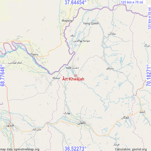
Ārt Khwājah GPS coordinates[2]
37° 5' 8.556" North, 69° 28' 46.488" East
| Map corner | latitude | longitude |
|---|---|---|
| Upper-left | 37.64454°, | 68.77646° |
| Center: | 37.08571°, | 69.47958° |
| Lower-right: | 36.52273°, | 70.18271° |
| Map W x H: | 124.7×124.7 km | = 77.5×77.5mi |
| max Lat: | 38.4435° ⇑6.1% North |
| Ārt Khwājah: | 37.08571° |
| min Lat: | ⇓93.9% South 30.15° |
| min Long | Ārt Khwājah | max Long |
| 61.06667° | 69.47958° | 72.318° |
| W 73.6%⇐ | ⇒26.4% E |
Elevation
Elevation of Ārt Khwājah is 481 m = 1578 ft, and this is 937.4 m = 3075 ft below average elevation for this country.
| Max E: |
3068 m = 10066 ft | 89.4% |
| Avg. | 1418.4 m = 4654 ft | |
| Ārt Khwājah | 481 m = 1578 ft | |
Min E: |
254 m = 833 ft | 10.6% |
See also: Afghanistan elevation on elevation.city.
Geographical zone
Ārt Khwājah is located in North temperate zone (between Tropic of Cancer and the Arctic Circle). Distance of this Northern Tropic circle is 1517.6 km =943 mi to South.| Distance of | km | miles | from Ārt Khwājah |
|---|---|---|---|
| North Pole | 5883.5 | 3655.8 | to North |
| Arctic Circle | 3277.6 | 2036.6 | to North |
| Tropic Cancer | 1517.6 | 943 | to South |
| Equator | 4123.5 | 2562.2 | to South |


Nearby cities:
15 places around Ārt Khwājah: (largest is in red/bold)
• Afaki
48.5 km =30.1 mi,  193°
193°
• Chāh Āb
45.6 km =28.3 mi,  40°
40°
• Darqad
33.3 km =20.7 mi,  355°
355°
• Dasht-e Archī
28.2 km =17.5 mi,  280°
280°
• Dasht-e Qal‘ah
8.2 km =5.1 mi,  337°
337°
• Imām Şāḩib
49.5 km =30.8 mi, 283°
• Kalafgān
54.1 km =33.6 mi,  130°
130°
• Khanabad
55.3 km =34.4 mi,  215°
215°
• Khwājah Ghār
5.6 km =3.5 mi,  246°
246°
• Khānaqāh
51.4 km =31.9 mi,  174°
174°
• Mashhad
62.9 km =39.1 mi,  118°
118°
• Rustāq
31.4 km =19.5 mi,  81°
81°
• Taloqan
39.2 km =24.4 mi, 172°
• Yangī Qal‘ah
43.8 km =27.2 mi,  15°
15°
• Ţāqchah Khānah
53.5 km =33.2 mi, 165°
Sources, notices
• [Note1] Compared only with cities in Afghanistan existing in our database
• [Src1] Map data: © OpenStreetMap contributors (CC-BY-SA)
• [Src2] Other city data from geonames.org with taken over terms of usage.
• [Src3] Geographical zone / Annual Mean Temperature by Robert A. Rohde @ Wikipedia
