Mashhad geodata
Mashhad (Badakhshan) is a seat of a second-order administrative division; located in Afghanistan in Asia/Kabul (GMT+4.5) time zone. In our database, there are 93 cities with bigger population. Compared to other cities in Afghanistan, 86.8% of cities are located further ↓South; 83.6% of cities are located further ←West and 66.9% of cities have higher elevation than Mashhad. Note1


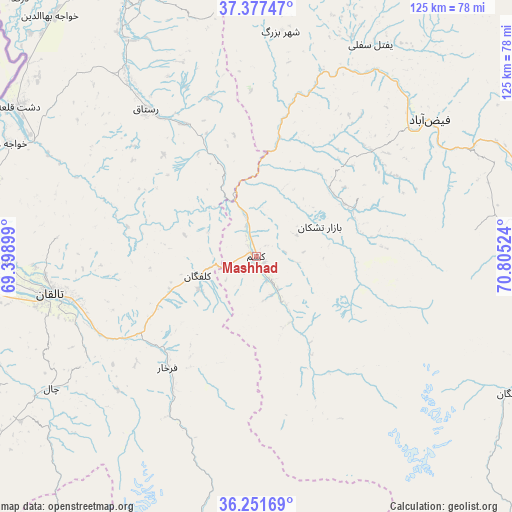
Mashhad GPS coordinates[2]
36° 48' 59.94" North, 70° 6' 7.596" East
| Map corner | latitude | longitude |
|---|---|---|
| Upper-left | 37.37747°, | 69.39899° |
| Center: | 36.81665°, | 70.10211° |
| Lower-right: | 36.25169°, | 70.80524° |
| Map W x H: | 125.2×125.2 km | = 77.8×77.8mi |
| max Lat: | 38.4435° ⇑13.2% North |
| Mashhad: | 36.81665° |
| min Lat: | ⇓86.8% South 30.15° |
| min Long | Mashhad | max Long |
| 61.06667° | 70.10211° | 72.318° |
| W 83.6%⇐ | ⇒16.4% E |
Elevation
Elevation of Mashhad is 977 m = 3205 ft, and this is 441.4 m = 1448 ft below average elevation for this country.
| Max E: |
3068 m = 10066 ft | 66.9% |
| Avg. | 1418.4 m = 4654 ft | |
| Mashhad | 977 m = 3205 ft | |
Min E: |
254 m = 833 ft | 33.1% |
See also: Afghanistan elevation on elevation.city.
Geographical zone
Mashhad is located in North temperate zone (between Tropic of Cancer and the Arctic Circle). Distance of this Northern Tropic circle is 1487.7 km =924.4 mi to South.| Distance of | km | miles | from Mashhad |
|---|---|---|---|
| North Pole | 5913.4 | 3674.4 | to North |
| Arctic Circle | 3307.5 | 2055.2 | to North |
| Tropic Cancer | 1487.7 | 924.4 | to South |
| Equator | 4093.6 | 2543.6 | to South |


Nearby cities:
15 places around Mashhad: (largest is in red/bold)
• Afaki
69.1 km =42.9 mi,  255°
255°
• Bāzār-e Tashkān
17.1 km =10.6 mi,  65°
65°
• Darāyim
25.6 km =15.9 mi,  77°
77°
• Farkhār
34.8 km =21.6 mi,  218°
218°
• Fayzabad
54 km =33.6 mi,  51°
51°
• Jurm
65.4 km =40.6 mi,  85°
85°
• Kalafgān
14.8 km =9.2 mi,  250°
250°
• Khwājah Ghār
66.5 km =41.3 mi,  294°
294°
• Khānaqāh
54.7 km =34 mi, 247°
• Rustāq
42 km =26.1 mi,  324°
324°
• Shahrān
59.5 km =37 mi, 72°
• Taloqan
51.3 km =31.9 mi, 259°
• Ārt Khwājah
62.9 km =39.1 mi,  298°
298°
• Ţāqchah Khānah
47.6 km =29.6 mi,  242°
242°
• Ḩāfiz̧ Moghul
37.6 km =23.4 mi,  44°
44°
Sources, notices
• [Note1] Compared only with cities in Afghanistan existing in our database
• [Src1] Map data: © OpenStreetMap contributors (CC-BY-SA)
• [Src2] Other city data from geonames.org with taken over terms of usage.
• [Src3] Geographical zone / Annual Mean Temperature by Robert A. Rohde @ Wikipedia
