Nīlī geodata
Nīlī (Daykundi) is a seat of a first-order administrative division; located in Afghanistan in Asia/Kabul (GMT+4.5) time zone. In our database, there are 93 cities with bigger population. Compared to other cities in Afghanistan, 70.1% of cities are located further ↑North; 70.4% of cities are located further →East and 76.2% of cities have lower elevation than Nīlī. Note1


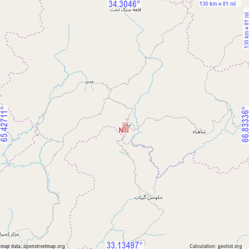
Nīlī GPS coordinates[2]
33° 43' 18.408" North, 66° 7' 48.828" East
| Map corner | latitude | longitude |
|---|---|---|
| Upper-left | 34.3046°, | 65.42711° |
| Center: | 33.72178°, | 66.13023° |
| Lower-right: | 33.13497°, | 66.83336° |
| Map W x H: | 130.1×130.1 km | = 80.8×80.8mi |
| max Lat: | 38.4435° ⇑70.1% North |
| Nīlī: | 33.72178° |
| min Lat: | ⇓29.9% South 30.15° |
| min Long | Nīlī | max Long |
| 61.06667° | 66.13023° | 72.318° |
| W 29.6%⇐ | ⇒70.4% E |
Elevation
Elevation of Nīlī is 2069 m = 6788 ft, and this is 650.6 m = 2135 ft above average elevation for this country.
| Max E: |
3068 m = 10066 ft | 23.8% |
| Nīlī | 2069 m 6788 ft | |
| Avg. | 1418.4 m = 4654 ft | |
Min E: |
254 m = 833 ft | 76.2% |
See also: Afghanistan elevation on elevation.city.
Geographical zone
Nīlī is located in North temperate zone (between Tropic of Cancer and the Arctic Circle). Distance of this Northern Tropic circle is 1143.6 km =710.6 mi to South.| Distance of | km | miles | from Nīlī |
|---|---|---|---|
| North Pole | 6257.6 | 3888.3 | to North |
| Arctic Circle | 3651.7 | 2269.1 | to North |
| Tropic Cancer | 1143.6 | 710.6 | to South |
| Equator | 3749.5 | 2329.8 | to South |


Nearby cities:
15 places around Nīlī: (largest is in red/bold)
• Chowṉêy
39.9 km =24.8 mi,  160°
160°
• Dowlatyār
97.3 km =60.5 mi,  341°
341°
• Dū Laīnah
133.1 km =82.7 mi,  291°
291°
• Fayrōz Kōh
120.1 km =74.6 mi,  317°
317°
• Kajrān
83.9 km =52.1 mi,  226°
226°
• Khadīr
28.7 km =17.8 mi, 320°
• Khākirān
131.7 km =81.8 mi,  138°
138°
• La‘l
87.8 km =54.6 mi,  9°
9°
• Nayak
135.6 km =84.3 mi,  33°
33°
• Panjāb
110.7 km =68.8 mi,  48°
48°
• Pasāband
118.2 km =73.4 mi,  268°
268°
• Quchanghī
40.2 km =25 mi,  19°
19°
• Sar-e Tayghān
48.2 km =30 mi,  240°
240°
• Tarinkot
123.6 km =76.8 mi,  190°
190°
• Uruzgān
99.9 km =62.1 mi,  152°
152°
Sources, notices
• [Note1] Compared only with cities in Afghanistan existing in our database
• [Src1] Map data: © OpenStreetMap contributors (CC-BY-SA)
• [Src2] Other city data from geonames.org with taken over terms of usage.
• [Src3] Geographical zone / Annual Mean Temperature by Robert A. Rohde @ Wikipedia
