Dê Nārkhēl Kêlay geodata
Dê Nārkhēl Kêlay (Kandahar) is a seat of a second-order administrative division; located in Afghanistan in Asia/Kabul (GMT+4.5) time zone. In our database, there are 93 cities with bigger population. Compared to other cities in Afghanistan, 89.1% of cities are located further ↑North; 75.9% of cities are located further →East and 53.1% of cities have lower elevation than Dê Nārkhēl Kêlay. Note1


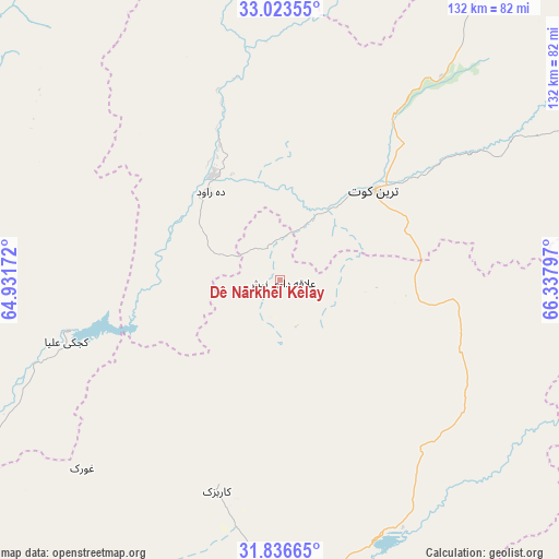
Dê Nārkhēl Kêlay GPS coordinates[2]
32° 25' 55.38" North, 65° 38' 5.424" East
| Map corner | latitude | longitude |
|---|---|---|
| Upper-left | 33.02355°, | 64.93172° |
| Center: | 32.43205°, | 65.63484° |
| Lower-right: | 31.83665°, | 66.33797° |
| Map W x H: | 132×132 km | = 82×82mi |
| max Lat: | 38.4435° ⇑89.1% North |
| Dê Nārkhēl Kêlay: | 32.43205° |
| min Lat: | ⇓10.9% South 30.15° |
| min Long | Dê Nārkhēl K | max Long |
| 61.06667° | 65.63484° | 72.318° |
| W 24.1%⇐ | ⇒75.9% E |
Elevation
Elevation of Dê Nārkhēl Kêlay is 1478 m = 4849 ft, and this is 59.6 m = 196 ft above average elevation for this country.
| Max E: |
3068 m = 10066 ft | 46.9% |
| Dê Nārkhēl Kêlay | 1478 m 4849 ft | |
| Avg. | 1418.4 m = 4654 ft | |
Min E: |
254 m = 833 ft | 53.1% |
See also: Afghanistan elevation on elevation.city.
Geographical zone
Dê Nārkhēl Kêlay is located in North temperate zone (between Tropic of Cancer and the Arctic Circle). Distance of this Northern Tropic circle is 1000.2 km =621.5 mi to South.| Distance of | km | miles | from Dê Nārkhēl Kêlay |
|---|---|---|---|
| North Pole | 6401 | 3977.4 | to North |
| Arctic Circle | 3795.1 | 2358.2 | to North |
| Tropic Cancer | 1000.2 | 621.5 | to South |
| Equator | 3606.1 | 2240.7 | to South |


Nearby cities:
15 places around Dê Nārkhēl Kêlay: (largest is in red/bold)
• Babasakhib
85.7 km =53.3 mi,  178°
178°
• Chinār
67.9 km =42.2 mi,  227°
227°
• Kajrān
87.1 km =54.1 mi,  350°
350°
• Kandahār
91.3 km =56.7 mi, 175°
• Kishk-e Nakhūd
105 km =65.2 mi,  211°
211°
• Mīzān ‘Alāqahdārī
87.3 km =54.2 mi,  109°
109°
• Mūsá Qal‘ah
83.5 km =51.9 mi,  271°
271°
• Nāyak
108 km =67.1 mi,  81°
81°
• Pāshmūl
99.1 km =61.6 mi,  191°
191°
• Sangīn
85.1 km =52.9 mi,  241°
241°
• Shahr-e Şafā
95.4 km =59.3 mi,  137°
137°
• Tarinkot
31.7 km =19.7 mi,  46°
46°
• Uruzgān
108.4 km =67.4 mi,  59°
59°
• Zamtō Kêlay
51.3 km =31.9 mi,  97°
97°
• Zīārat-e Shāh Maqşūd
52 km =32.3 mi,  196°
196°
Sources, notices
• [Note1] Compared only with cities in Afghanistan existing in our database
• [Src1] Map data: © OpenStreetMap contributors (CC-BY-SA)
• [Src2] Other city data from geonames.org with taken over terms of usage.
• [Src3] Geographical zone / Annual Mean Temperature by Robert A. Rohde @ Wikipedia
