Farkhār geodata
Farkhār (Takhar) is a seat of a second-order administrative division; located in Afghanistan in Asia/Kabul (GMT+4.5) time zone. With population of 10,480 people, there are 66 cities with bigger population in this country. Compared to other cities in Afghanistan, 81.7% of cities are located further ↓South; 80.4% of cities are located further ←West and 60.1% of cities have higher elevation than Farkhār. Note1


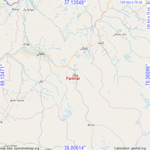
Farkhār GPS coordinates[2]
36° 34' 22.368" North, 69° 51' 28.188" East
| Map corner | latitude | longitude |
|---|---|---|
| Upper-left | 37.13549°, | 69.15471° |
| Center: | 36.57288°, | 69.85783° |
| Lower-right: | 36.00614°, | 70.56096° |
| Map W x H: | 125.6×125.6 km | = 78×78mi |
| max Lat: | 38.4435° ⇑18.3% North |
| Farkhār: | 36.57288° |
| min Lat: | ⇓81.7% South 30.15° |
| min Long | Farkhār | max Long |
| 61.06667° | 69.85783° | 72.318° |
| W 80.4%⇐ | ⇒19.6% E |
Elevation
Elevation of Farkhār is 1153 m = 3783 ft, and this is 265.4 m = 871 ft below average elevation for this country.
| Max E: |
3068 m = 10066 ft | 60.1% |
| Avg. | 1418.4 m = 4654 ft | |
| Farkhār | 1153 m = 3783 ft | |
Min E: |
254 m = 833 ft | 39.9% |
See also: Afghanistan elevation on elevation.city.
Geographical zone
Farkhār is located in North temperate zone (between Tropic of Cancer and the Arctic Circle). Distance of this Northern Tropic circle is 1460.6 km =907.6 mi to South.| Distance of | km | miles | from Farkhār |
|---|---|---|---|
| North Pole | 5940.5 | 3691.3 | to North |
| Arctic Circle | 3334.7 | 2072.1 | to North |
| Tropic Cancer | 1460.6 | 907.6 | to South |
| Equator | 4066.5 | 2526.8 | to South |


Nearby cities:
15 places around Farkhār: (largest is in red/bold)
• Afaki
46.3 km =28.8 mi,  282°
282°
• Bāzār-e Tashkān
50.7 km =31.5 mi,  47°
47°
• Būrkah
74.3 km =46.2 mi,  238°
238°
• Darāyim
57.1 km =35.5 mi,  55°
55°
• Dasht-e Qal‘ah
74.4 km =46.2 mi,  330°
330°
• Kalafgān
23.5 km =14.6 mi,  19°
19°
• Khanabad
67.3 km =41.8 mi, 280°
• Khwājah Ghār
67.2 km =41.8 mi,  324°
324°
• Khānaqāh
29.2 km =18.1 mi, 281°
• Mashhad
34.8 km =21.6 mi,  38°
38°
• Rustāq
61.6 km =38.3 mi,  357°
357°
• Taloqan
34.1 km =21.2 mi,  302°
302°
• Ārt Khwājah
66.2 km =41.1 mi, 329°
• Ţāqchah Khānah
21.1 km =13.1 mi, 284°
• Ḩāfiz̧ Moghul
72.3 km =44.9 mi, 41°
Sources, notices
• [Note1] Compared only with cities in Afghanistan existing in our database
• [Src1] Map data: © OpenStreetMap contributors (CC-BY-SA)
• [Src2] Other city data from geonames.org with taken over terms of usage.
• [Src3] Geographical zone / Annual Mean Temperature by Robert A. Rohde @ Wikipedia
