Chinār geodata
Chinār (Kandahar) is a seat of a second-order administrative division; located in Afghanistan in Asia/Kabul (GMT+4.5) time zone. In our database, there are 93 cities with bigger population. Compared to other cities in Afghanistan, 92.6% of cities are located further ↑North; 79.7% of cities are located further →East and 61.4% of cities have higher elevation than Chinār. Note1


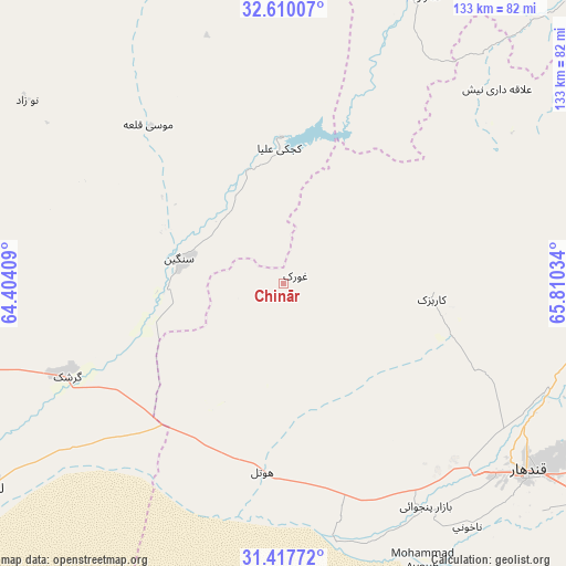
Chinār GPS coordinates[2]
32° 0' 56.988" North, 65° 6' 25.956" East
| Map corner | latitude | longitude |
|---|---|---|
| Upper-left | 32.61007°, | 64.40409° |
| Center: | 32.01583°, | 65.10721° |
| Lower-right: | 31.41772°, | 65.81034° |
| Map W x H: | 132.6×132.6 km | = 82.4×82.4mi |
| max Lat: | 38.4435° ⇑92.6% North |
| Chinār: | 32.01583° |
| min Lat: | ⇓7.4% South 30.15° |
| min Long | Chinār | max Long |
| 61.06667° | 65.10721° | 72.318° |
| W 20.3%⇐ | ⇒79.7% E |
Elevation
Elevation of Chinār is 1132 m = 3714 ft, and this is 286.4 m = 940 ft below average elevation for this country.
| Max E: |
3068 m = 10066 ft | 61.4% |
| Avg. | 1418.4 m = 4654 ft | |
| Chinār | 1132 m = 3714 ft | |
Min E: |
254 m = 833 ft | 38.6% |
See also: Afghanistan elevation on elevation.city.
Geographical zone
Chinār is located in North temperate zone (between Tropic of Cancer and the Arctic Circle). Distance of this Northern Tropic circle is 953.9 km =592.7 mi to South.| Distance of | km | miles | from Chinār |
|---|---|---|---|
| North Pole | 6447.2 | 4006.1 | to North |
| Arctic Circle | 3841.3 | 2386.9 | to North |
| Tropic Cancer | 953.9 | 592.7 | to South |
| Equator | 3559.8 | 2212 | to South |


Nearby cities:
15 places around Chinār: (largest is in red/bold)
• Babasakhib
65.5 km =40.7 mi,  126°
126°
• Dê Nārkhēl Kêlay
67.9 km =42.2 mi,  47°
47°
• Gereshk
55.1 km =34.2 mi,  246°
246°
• Kandahār
72.4 km =45 mi, 128°
• Kishk-e Nakhūd
43.7 km =27.2 mi,  186°
186°
• Lashkar Gāh
83.9 km =52.1 mi,  235°
235°
• Mūsá Qal‘ah
58.7 km =36.5 mi,  324°
324°
• Now Zād
73.8 km =45.9 mi,  305°
305°
• Pāshmūl
59.6 km =37 mi,  148°
148°
• Sangīn
26.3 km =16.3 mi,  283°
283°
• Shahr-e Şafā
117.2 km =72.8 mi,  101°
101°
• Tarinkot
99.5 km =61.8 mi, 46°
• Zamtō Kêlay
108.2 km =67.2 mi,  68°
68°
• Zīārat-e Shāh Maqşūd
34.7 km =21.6 mi, 95°
• Ḩukūmat-e Nād ‘Alī
91.8 km =57 mi, 243°
Sources, notices
• [Note1] Compared only with cities in Afghanistan existing in our database
• [Src1] Map data: © OpenStreetMap contributors (CC-BY-SA)
• [Src2] Other city data from geonames.org with taken over terms of usage.
• [Src3] Geographical zone / Annual Mean Temperature by Robert A. Rohde @ Wikipedia
