Pāshmūl geodata
Pāshmūl (Kandahar) is a seat of a second-order administrative division; located in Afghanistan in Asia/Kabul (GMT+4.5) time zone. In our database, there are 93 cities with bigger population. Compared to other cities in Afghanistan, 97.1% of cities are located further ↑North; 77.5% of cities are located further →East and 68.5% of cities have higher elevation than Pāshmūl. Note1


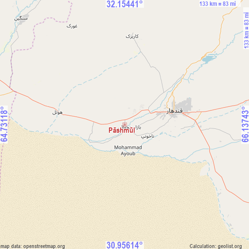
Pāshmūl GPS coordinates[2]
31° 33' 25.92" North, 65° 26' 3.48" East
| Map corner | latitude | longitude |
|---|---|---|
| Upper-left | 32.15441°, | 64.73118° |
| Center: | 31.5572°, | 65.4343° |
| Lower-right: | 30.95614°, | 66.13743° |
| Map W x H: | 133.2×133.2 km | = 82.8×82.8mi |
| max Lat: | 38.4435° ⇑97.1% North |
| Pāshmūl: | 31.5572° |
| min Lat: | ⇓2.9% South 30.15° |
| min Long | Pāshmūl | max Long |
| 61.06667° | 65.4343° | 72.318° |
| W 22.5%⇐ | ⇒77.5% E |
Elevation
Elevation of Pāshmūl is 946 m = 3104 ft, and this is 472.4 m = 1550 ft below average elevation for this country.
| Max E: |
3068 m = 10066 ft | 68.5% |
| Avg. | 1418.4 m = 4654 ft | |
| Pāshmūl | 946 m = 3104 ft | |
Min E: |
254 m = 833 ft | 31.5% |
See also: Afghanistan elevation on elevation.city.
Geographical zone
Pāshmūl is located in North temperate zone (between Tropic of Cancer and the Arctic Circle). Distance of this Northern Tropic circle is 902.9 km =561 mi to South.| Distance of | km | miles | from Pāshmūl |
|---|---|---|---|
| North Pole | 6498.2 | 4037.8 | to North |
| Arctic Circle | 3892.3 | 2418.6 | to North |
| Tropic Cancer | 902.9 | 561 | to South |
| Equator | 3508.8 | 2180.3 | to South |


Nearby cities:
15 places around Pāshmūl: (largest is in red/bold)
• Arghestān
100 km =62.1 mi,  89°
89°
• Babasakhib
24.4 km =15.2 mi,  61°
61°
• Chinār
59.6 km =37 mi,  328°
328°
• Dê Nārkhēl Kêlay
99.1 km =61.6 mi,  11°
11°
• Gereshk
86.9 km =54 mi,  289°
289°
• Kandahār
26.9 km =16.7 mi,  76°
76°
• Khūgyāṉī
108.7 km =67.5 mi, 89°
• Kishk-e Nakhūd
36.7 km =22.8 mi,  281°
281°
• Lashkar Gāh
100.7 km =62.6 mi,  272°
272°
• Sangīn
80.5 km =50 mi,  315°
315°
• Shahr-e Şafā
88.5 km =55 mi,  71°
71°
• Spīn Bōldak
110.4 km =68.6 mi,  123°
123°
• Zamtō Kêlay
114.6 km =71.2 mi,  37°
37°
• Zīārat-e Shāh Maqşūd
47.7 km =29.6 mi,  4°
4°
• Ḩukūmat-e Nād ‘Alī
113.5 km =70.5 mi, 274°
Sources, notices
• [Note1] Compared only with cities in Afghanistan existing in our database
• [Src1] Map data: © OpenStreetMap contributors (CC-BY-SA)
• [Src2] Other city data from geonames.org with taken over terms of usage.
• [Src3] Geographical zone / Annual Mean Temperature by Robert A. Rohde @ Wikipedia
