Kajrān geodata
Kajrān (Daykundi) is a seat of a second-order administrative division; located in Afghanistan in Asia/Kabul (GMT+4.5) time zone. In our database, there are 93 cities with bigger population. Compared to other cities in Afghanistan, 78.8% of cities are located further ↑North; 77.2% of cities are located further →East and 50.5% of cities have lower elevation than Kajrān. Note1


Kajrān GPS coordinates[2]
33° 12' 12.852" North, 65° 28' 23.196" East
| Map corner | latitude | longitude |
|---|---|---|
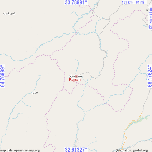
| Upper-left | 33.78991°, | 64.76999° |
| Center: | 33.20357°, | 65.47311° |
| Lower-right: | 32.61327°, | 66.17624° |
| Map W x H: | 130.8×130.8 km | = 81.3×81.3mi |
| max Lat: | 38.4435° ⇑78.8% North |
| Kajrān: | 33.20357° |
| min Lat: | ⇓21.2% South 30.15° |
| min Long | Kajrān | max Long |
| 61.06667° | 65.47311° | 72.318° |
| W 22.8%⇐ | ⇒77.2% E |
Elevation
Elevation of Kajrān is 1364 m = 4475 ft, and this is 54.4 m = 178 ft below average elevation for this country.
| Max E: |
3068 m = 10066 ft | 49.5% |
| Avg. | 1418.4 m = 4654 ft | |
| Kajrān | 1364 m = 4475 ft | |
Min E: |
254 m = 833 ft | 50.5% |
See also: Afghanistan elevation on elevation.city.
Geographical zone
Kajrān is located in North temperate zone (between Tropic of Cancer and the Arctic Circle). Distance of this Northern Tropic circle is 1086 km =674.8 mi to South.| Distance of | km | miles | from Kajrān |
|---|---|---|---|
| North Pole | 6315.2 | 3924.1 | to North |
| Arctic Circle | 3709.3 | 2304.9 | to North |
| Tropic Cancer | 1086 | 674.8 | to South |
| Equator | 3691.9 | 2294 | to South |


Nearby cities:
15 places around Kajrān: (largest is in red/bold)
• Chowṉêy
76.9 km =47.8 mi,  74°
74°
• Dê Nārkhēl Kêlay
87.1 km =54.1 mi,  170°
170°
• Dū Laīnah
123.5 km =76.7 mi,  329°
329°
• Khadīr
90.6 km =56.3 mi,  28°
28°
• Mūsá Qal‘ah
108.3 km =67.3 mi,  218°
218°
• Now Zād
129.3 km =80.3 mi,  226°
226°
• Nīlī
83.9 km =52.1 mi,  46°
46°
• Pasāband
78.9 km =49 mi,  313°
313°
• Quchanghī
121.1 km =75.2 mi,  37°
37°
• Sar-e Tayghān
38.9 km =24.2 mi, 28°
• Tarinkot
74.1 km =46 mi,  149°
149°
• Taywarah
103.9 km =64.6 mi,  289°
289°
• Uruzgān
112.3 km =69.8 mi,  105°
105°
• Zamtō Kêlay
113.4 km =70.5 mi,  144°
144°
• Zīārat-e Shāh Maqşūd
135.5 km =84.2 mi,  179°
179°
Sources, notices
• [Note1] Compared only with cities in Afghanistan existing in our database
• [Src1] Map data: © OpenStreetMap contributors (CC-BY-SA)
• [Src2] Other city data from geonames.org with taken over terms of usage.
• [Src3] Geographical zone / Annual Mean Temperature by Robert A. Rohde @ Wikipedia
