Balkh geodata
Balkh is a seat of a second-order administrative division; located in Afghanistan in Asia/Kabul (GMT+4.5) time zone. With population of 114,883 people, there are 7 cities with bigger population in this country. Compared to other cities in Afghanistan, 86.2% of cities are located further ↓South; 62.4% of cities are located further →East and 94.9% of cities have higher elevation than Balkh. Note1


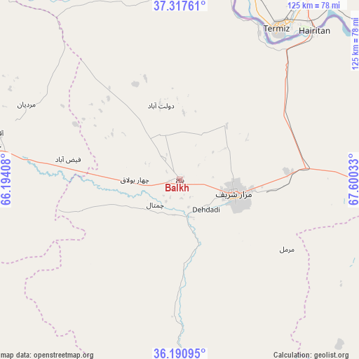
Balkh GPS coordinates[2]
36° 45' 22.86" North, 66° 53' 49.92" East
| Map corner | latitude | longitude |
|---|---|---|
| Upper-left | 37.31761°, | 66.19408° |
| Center: | 36.75635°, | 66.8972° |
| Lower-right: | 36.19095°, | 67.60033° |
| Map W x H: | 125.3×125.3 km | = 77.9×77.9mi |
| max Lat: | 38.4435° ⇑13.8% North |
| Balkh: | 36.75635° |
| min Lat: | ⇓86.2% South 30.15° |
| min Long | Balkh | max Long |
| 61.06667° | 66.8972° | 72.318° |
| W 37.6%⇐ | ⇒62.4% E |
Elevation
Elevation of Balkh is 348 m = 1142 ft, and this is 1070.4 m = 3512 ft below average elevation for this country.
| Max E: |
3068 m = 10066 ft | 94.9% |
| Avg. | 1418.4 m = 4654 ft | |
| Balkh | 348 m = 1142 ft | |
Min E: |
254 m = 833 ft | 5.1% |
See also: Balkh elevation on elevation.city.
Geographical zone
Balkh is located in North temperate zone (between Tropic of Cancer and the Arctic Circle). Distance of this Northern Tropic circle is 1481 km =920.3 mi to South.| Distance of | km | miles | from Balkh |
|---|---|---|---|
| North Pole | 5920.1 | 3678.6 | to North |
| Arctic Circle | 3314.3 | 2059.4 | to North |
| Tropic Cancer | 1481 | 920.3 | to South |
| Equator | 4086.9 | 2539.5 | to South |


Nearby cities:
15 places around Balkh: (largest is in red/bold)
• Chimtāl
12.1 km =7.5 mi,  223°
223°
• Dehdādī
13.4 km =8.3 mi,  140°
140°
• Dehī
95.1 km =59.1 mi,  158°
158°
• Dowlatābād
26.7 km =16.6 mi,  345°
345°
• Faīẕābād
39.7 km =24.7 mi,  280°
280°
• Khulm
71.7 km =44.6 mi,  95°
95°
• Khānaqāh
66.1 km =41.1 mi, 280°
• Lab-Sar
81.3 km =50.5 mi,  183°
183°
• Mardīān
59.5 km =37 mi,  296°
296°
• Mazār-e Sharīf
19.8 km =12.3 mi,  105°
105°
• Mingajik
74.8 km =46.5 mi,  293°
293°
• Qaranghū Tōghaī
83.4 km =51.8 mi,  52°
52°
• Qarchī Gak
33 km =20.5 mi,  343°
343°
• Āq Kupruk
75 km =46.6 mi, 183°
• Āqchah
65.6 km =40.8 mi, 284°
Sources, notices
• [Note1] Compared only with cities in Afghanistan existing in our database
• [Src1] Map data: © OpenStreetMap contributors (CC-BY-SA)
• [Src2] Other city data from geonames.org with taken over terms of usage.
• [Src3] Geographical zone / Annual Mean Temperature by Robert A. Rohde @ Wikipedia
