Qarchī Gak geodata
Qarchī Gak (Balkh) is a populated place; located in Afghanistan in Asia/Kabul (GMT+4.5) time zone. With population of 8,942 people, there are 76 cities with bigger population in this country. Compared to other cities in Afghanistan, 92.9% of cities are located further ↓South; 64% of cities are located further →East and 97.4% of cities have higher elevation than Qarchī Gak. Note1


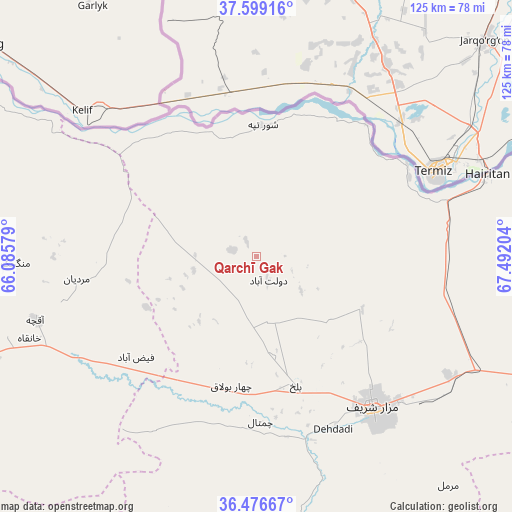
Qarchī Gak GPS coordinates[2]
37° 2' 23.964" North, 66° 47' 20.076" East
| Map corner | latitude | longitude |
|---|---|---|
| Upper-left | 37.59916°, | 66.08579° |
| Center: | 37.03999°, | 66.78891° |
| Lower-right: | 36.47667°, | 67.49204° |
| Map W x H: | 124.8×124.8 km | = 77.5×77.5mi |
| max Lat: | 38.4435° ⇑7.1% North |
| Qarchī Gak: | 37.03999° |
| min Lat: | ⇓92.9% South 30.15° |
| min Long | Qarchī Gak | max Long |
| 61.06667° | 66.78891° | 72.318° |
| W 36%⇐ | ⇒64% E |
Elevation
Elevation of Qarchī Gak is 306 m = 1004 ft, and this is 1112.4 m = 3650 ft below average elevation for this country.
| Max E: |
3068 m = 10066 ft | 97.4% |
| Avg. | 1418.4 m = 4654 ft | |
| Qarchī Gak | 306 m = 1004 ft | |
Min E: |
254 m = 833 ft | 2.6% |
See also: Afghanistan elevation on elevation.city.
Geographical zone
Qarchī Gak is located in North temperate zone (between Tropic of Cancer and the Arctic Circle). Distance of this Northern Tropic circle is 1512.5 km =939.8 mi to South.| Distance of | km | miles | from Qarchī Gak |
|---|---|---|---|
| North Pole | 5888.6 | 3659 | to North |
| Arctic Circle | 3282.7 | 2039.8 | to North |
| Tropic Cancer | 1512.5 | 939.8 | to South |
| Equator | 4118.5 | 2559.1 | to South |


Nearby cities:
15 places around Qarchī Gak: (largest is in red/bold)
• Balkh
33 km =20.5 mi,  163°
163°
• Chimtāl
40.2 km =25 mi,  178°
178°
• Dehdādī
45.7 km =28.4 mi, 156°
• Dowlatābād
6.4 km =4 mi,  153°
153°
• Faīẕābād
38.1 km =23.7 mi,  230°
230°
• Khulm
89.4 km =55.6 mi,  115°
115°
• Khwājah Dū Kōh
106.1 km =65.9 mi,  257°
257°
• Khānaqāh
58.7 km =36.5 mi,  250°
250°
• Mardīān
44 km =27.3 mi, 263°
• Mazār-e Sharīf
46.6 km =29 mi,  142°
142°
• Mingajik
58.7 km =36.5 mi,  268°
268°
• Qaranghū Tōghaī
77.9 km =48.4 mi,  75°
75°
• Qarqīn
78.3 km =48.7 mi,  302°
302°
• Shibirghān
101 km =62.8 mi, 245°
• Āqchah
55.8 km =34.7 mi, 254°
Sources, notices
• [Note1] Compared only with cities in Afghanistan existing in our database
• [Src1] Map data: © OpenStreetMap contributors (CC-BY-SA)
• [Src2] Other city data from geonames.org with taken over terms of usage.
• [Src3] Geographical zone / Annual Mean Temperature by Robert A. Rohde @ Wikipedia
