Qaranghū Tōghaī geodata
Qaranghū Tōghaī (Balkh) is a seat of a second-order administrative division; located in Afghanistan in Asia/Kabul (GMT+4.5) time zone. In our database, there are 93 cities with bigger population. Compared to other cities in Afghanistan, 95.8% of cities are located further ↓South; 57.6% of cities are located further →East and 97.7% of cities have higher elevation than Qaranghū Tōghaī. Note1


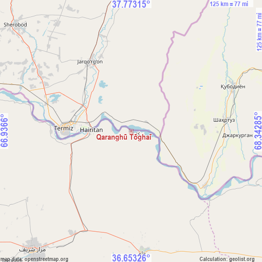
Qaranghū Tōghaī GPS coordinates[2]
37° 12' 55.008" North, 67° 38' 22.992" East
| Map corner | latitude | longitude |
|---|---|---|
| Upper-left | 37.77315°, | 66.9366° |
| Center: | 37.21528°, | 67.63972° |
| Lower-right: | 36.65326°, | 68.34285° |
| Map W x H: | 124.5×124.5 km | = 77.4×77.4mi |
| max Lat: | 38.4435° ⇑4.2% North |
| Qaranghū Tōghaī: | 37.21528° |
| min Lat: | ⇓95.8% South 30.15° |
| min Long | Qaranghū Tōgh | max Long |
| 61.06667° | 67.63972° | 72.318° |
| W 42.4%⇐ | ⇒57.6% E |
Elevation
Elevation of Qaranghū Tōghaī is 301 m = 988 ft, and this is 1117.4 m = 3666 ft below average elevation for this country.
| Max E: |
3068 m = 10066 ft | 97.7% |
| Avg. | 1418.4 m = 4654 ft | |
| Qaranghū Tōghaī | 301 m = 988 ft | |
Min E: |
254 m = 833 ft | 2.3% |
See also: Afghanistan elevation on elevation.city.
Geographical zone
Qaranghū Tōghaī is located in North temperate zone (between Tropic of Cancer and the Arctic Circle). Distance of this Northern Tropic circle is 1532 km =951.9 mi to South.| Distance of | km | miles | from Qaranghū Tōghaī |
|---|---|---|---|
| North Pole | 5869.1 | 3646.9 | to North |
| Arctic Circle | 3263.2 | 2027.7 | to North |
| Tropic Cancer | 1532 | 951.9 | to South |
| Equator | 4138 | 2571.2 | to South |


Nearby cities:
15 places around Qaranghū Tōghaī: (largest is in red/bold)
• Aībak
110.9 km =68.9 mi,  162°
162°
• Balkh
83.4 km =51.8 mi,  232°
232°
• Chimtāl
95.3 km =59.2 mi, 231°
• Dehdādī
84.1 km =52.3 mi,  223°
223°
• Dowlatābād
76.9 km =47.8 mi,  250°
250°
• Dowr-e Rabāţ
117.7 km =73.1 mi,  119°
119°
• Faīẕābād
113.6 km =70.6 mi, 247°
• Imām Şāḩib
114.9 km =71.4 mi,  91°
91°
• Khulm
57.8 km =35.9 mi,  174°
174°
• Kunduz
120.9 km =75.1 mi, 116°
• Mardīān
121.7 km =75.6 mi,  258°
258°
• Mazār-e Sharīf
73.3 km =45.5 mi, 219°
• Qarchī Gak
77.9 km =48.4 mi, 255°
• Qarāwul
101 km =62.8 mi, 89°
• Āqchah
133.7 km =83.1 mi, 255°
Sources, notices
• [Note1] Compared only with cities in Afghanistan existing in our database
• [Src1] Map data: © OpenStreetMap contributors (CC-BY-SA)
• [Src2] Other city data from geonames.org with taken over terms of usage.
• [Src3] Geographical zone / Annual Mean Temperature by Robert A. Rohde @ Wikipedia
