Mathba geodata
Mathba (Barisāl) is a populated place; located in Bangladesh in Asia/Dhaka (GMT+6) time zone. With population of 29,760 people, there are 100 cities with bigger population in this country. Compared to other cities in Bangladesh, 95.7% of cities are located further ↑North; 55.6% of cities are located further →East and 81.2% of cities have higher elevation than Mathba. Note1
Administrative division(s):
- Level 1: Barisāl
- Level 2: Pirojpur
- Level 3: Mathbaria Upazila
- Level 4: Mathbaria


Mathba GPS coordinates[2]
22° 17' 10.176" North, 89° 57' 31.788" East
| Map corner | latitude | longitude |
|---|---|---|
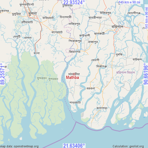
| Upper-left | 22.93524°, | 89.25571° |
| Center: | 22.28616°, | 89.95883° |
| Lower-right: | 21.63406°, | 90.66196° |
| Map W x H: | 144.7×144.7 km | = 89.9×89.9mi |
| max Lat: | 26.33338° ⇑95.7% North |
| Mathba: | 22.28616° |
| min Lat: | ⇓4.3% South 20.85829° |
| min Long | Mathba | max Long |
| 88.15638° | 89.95883° | 92.29773° |
| W 44.4%⇐ | ⇒55.6% E |
Elevation
Elevation of Mathba is 10 m = 33 ft, and this is 7.9 m = 26 ft below average elevation for this country.
| Max E: |
79 m = 259 ft | 81.2% |
| Avg. | 17.9 m = 59 ft | |
| Mathba | 10 m = 33 ft | |
Min E: |
2 m = 7 ft | 18.8% |
See also: Bangladesh elevation on elevation.city.
Geographical zone
Mathba is located in North Torrid zone (between Equator and Tropic of Cancer). Distance of this Northern Tropic circle is 127.9 km =79.5 mi to North.| Distance of | km | miles | from Mathba |
|---|---|---|---|
| North Pole | 7529.1 | 4678.4 | to North |
| Arctic Circle | 4923.2 | 3059.1 | to North |
| Tropic Cancer | 127.9 | 79.5 | to North |
| Equator | 2478 | 1539.8 | to South |


Nearby cities:
15 places around Mathba: (largest is in red/bold)
• Bagerhat
44.6 km =27.7 mi,  337°
337°
• Barisāl
62.9 km =39.1 mi,  42°
42°
• Bhola
83.4 km =51.8 mi,  57°
57°
• Bhāndāria
25 km =15.5 mi,  25°
25°
• Burhānuddin
82 km =51 mi,  73°
73°
• Gaurnadi
81.1 km =50.4 mi,  19°
19°
• Khulna
70.9 km =44.1 mi,  325°
325°
• Lālmohan
80.3 km =49.9 mi,  85°
85°
• Morrelgonj
21.6 km =13.4 mi, 330°
• Nālchiti
50.6 km =31.4 mi, 39°
• Phultala
66.3 km =41.2 mi,  316°
316°
• Pirojpur
32.7 km =20.3 mi,  2°
2°
• Sarankhola
17.5 km =10.9 mi,  278°
278°
• Tungipāra
68.5 km =42.6 mi,  355°
355°
• Uttar Char Fasson
77.9 km =48.4 mi, 94°
Sources, notices
• [Note1] Compared only with cities in Bangladesh existing in our database
• [Src1] Map data: © OpenStreetMap contributors (CC-BY-SA)
• [Src2] Other city data from geonames.org with taken over terms of usage.
• [Src3] Geographical zone / Annual Mean Temperature by Robert A. Rohde @ Wikipedia
