Nālchiti geodata
Nālchiti (Barisāl) is a populated place; located in Bangladesh in Asia/Dhaka (GMT+6) time zone. With population of 38,703 people, there are 84 cities with bigger population in this country. Compared to other cities in Bangladesh, 86.3% of cities are located further ↑North; 59.8% of cities are located further ←West and 92.3% of cities have higher elevation than Nālchiti. Note1
Administrative division(s):
- Level 1: Barisāl
- Level 2: Jhalokati
- Level 3: Nalchity
- Level 4: Paurashava


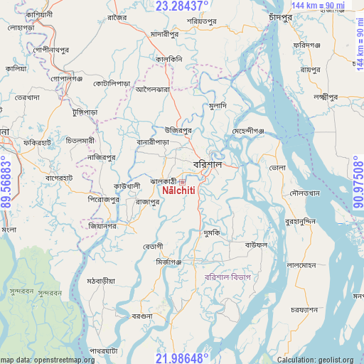
Nālchiti GPS coordinates[2]
22° 38' 13.056" North, 90° 16' 19.02" East
| Map corner | latitude | longitude |
|---|---|---|
| Upper-left | 23.28437°, | 89.56883° |
| Center: | 22.63696°, | 90.27195° |
| Lower-right: | 21.98648°, | 90.97508° |
| Map W x H: | 144.3×144.3 km | = 89.7×89.7mi |
| max Lat: | 26.33338° ⇑86.3% North |
| Nālchiti: | 22.63696° |
| min Lat: | ⇓13.7% South 20.85829° |
| min Long | Nālchiti | max Long |
| 88.15638° | 90.27195° | 92.29773° |
| W 59.8%⇐ | ⇒40.2% E |
Elevation
Elevation of Nālchiti is 8 m = 26 ft, and this is 9.9 m = 32 ft below average elevation for this country.
| Max E: |
79 m = 259 ft | 92.3% |
| Avg. | 17.9 m = 59 ft | |
| Nālchiti | 8 m = 26 ft | |
Min E: |
2 m = 7 ft | 7.7% |
See also: Bangladesh elevation on elevation.city.
Geographical zone
Nālchiti is located in North Torrid zone (between Equator and Tropic of Cancer). Distance of this Northern Tropic circle is 88.9 km =55.2 mi to North.| Distance of | km | miles | from Nālchiti |
|---|---|---|---|
| North Pole | 7490.1 | 4654.1 | to North |
| Arctic Circle | 4884.2 | 3034.9 | to North |
| Tropic Cancer | 88.9 | 55.2 | to North |
| Equator | 2517 | 1564 | to South |


Nearby cities:
15 places around Nālchiti: (largest is in red/bold)
• Bagerhat
49.4 km =30.7 mi,  272°
272°
• Barisāl
12.6 km =7.8 mi,  53°
53°
• Bhola
38.6 km =24 mi,  81°
81°
• Bhāndāria
27.1 km =16.8 mi,  232°
232°
• Burhānuddin
49 km =30.4 mi,  108°
108°
• Gaurnadi
37.8 km =23.5 mi,  352°
352°
• Lālmohan
58.2 km =36.2 mi,  124°
124°
• Mathba
50.6 km =31.4 mi,  219°
219°
• Mehendiganj
33.4 km =20.8 mi, 51°
• Morrelgonj
47.2 km =29.3 mi,  244°
244°
• Mādārīpur
59.7 km =37.1 mi, 353°
• Pirojpur
31.1 km =19.3 mi,  258°
258°
• Sarankhola
61.3 km =38.1 mi, 233°
• Tungipāra
47.8 km =29.7 mi,  307°
307°
• Uttar Char Fasson
64.3 km =40 mi,  135°
135°
Sources, notices
• [Note1] Compared only with cities in Bangladesh existing in our database
• [Src1] Map data: © OpenStreetMap contributors (CC-BY-SA)
• [Src2] Other city data from geonames.org with taken over terms of usage.
• [Src3] Geographical zone / Annual Mean Temperature by Robert A. Rohde @ Wikipedia
