Mehendiganj geodata
Mehendiganj (Barisāl) is a populated place; located in Bangladesh in Asia/Dhaka (GMT+6) time zone. With population of 39,424 people, there are 81 cities with bigger population in this country. Compared to other cities in Bangladesh, 79.5% of cities are located further ↑North; 67.5% of cities are located further ←West and 88.9% of cities have higher elevation than Mehendiganj. Note1
Administrative division(s):
- Level 1: Barisāl
- Level 2: Barisal
- Level 3: Mehendiganj Upazila
- Level 4: Mehendiganj


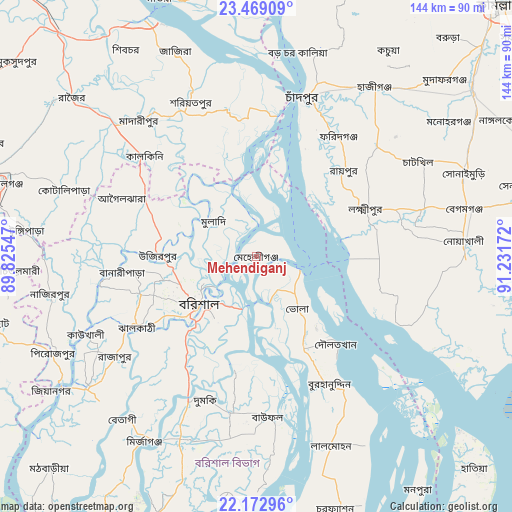
Mehendiganj GPS coordinates[2]
22° 49' 21.252" North, 90° 31' 42.924" East
| Map corner | latitude | longitude |
|---|---|---|
| Upper-left | 23.46909°, | 89.82547° |
| Center: | 22.82257°, | 90.52859° |
| Lower-right: | 22.17296°, | 91.23172° |
| Map W x H: | 144.1×144.1 km | = 89.5×89.5mi |
| max Lat: | 26.33338° ⇑79.5% North |
| Mehendiganj: | 22.82257° |
| min Lat: | ⇓20.5% South 20.85829° |
| min Long | Mehendiganj | max Long |
| 88.15638° | 90.52859° | 92.29773° |
| W 67.5%⇐ | ⇒32.5% E |
Elevation
Elevation of Mehendiganj is 9 m = 30 ft, and this is 8.9 m = 29 ft below average elevation for this country.
| Max E: |
79 m = 259 ft | 88.9% |
| Avg. | 17.9 m = 59 ft | |
| Mehendiganj | 9 m = 30 ft | |
Min E: |
2 m = 7 ft | 11.1% |
See also: Bangladesh elevation on elevation.city.
Geographical zone
Mehendiganj is located in North Torrid zone (between Equator and Tropic of Cancer). Distance of this Northern Tropic circle is 68.3 km =42.4 mi to North.| Distance of | km | miles | from Mehendiganj |
|---|---|---|---|
| North Pole | 7469.4 | 4641.3 | to North |
| Arctic Circle | 4863.5 | 3022 | to North |
| Tropic Cancer | 68.3 | 42.4 | to North |
| Equator | 2537.6 | 1576.8 | to South |


Nearby cities:
15 places around Mehendiganj: (largest is in red/bold)
• Barisāl
20.9 km =13 mi,  231°
231°
• Bhola
19.1 km =11.9 mi,  141°
141°
• Bhāndāria
60.5 km =37.6 mi, 232°
• Burhānuddin
41.6 km =25.8 mi,  151°
151°
• Char Bhadrāsan
62.3 km =38.7 mi,  330°
330°
• Gaurnadi
35.5 km =22.1 mi,  298°
298°
• Hājīganj
58.3 km =36.2 mi,  34°
34°
• Lakshmīpur
33.7 km =20.9 mi,  66°
66°
• Lālmohan
58 km =36 mi,  158°
158°
• Mādārīpur
50.7 km =31.5 mi,  319°
319°
• Nālchiti
33.4 km =20.8 mi, 231°
• Pirojpur
62.9 km =39.1 mi,  244°
244°
• Pālang
47.6 km =29.6 mi,  337°
337°
• Rāipur
34.4 km =21.4 mi,  45°
45°
• Rāmganj
45.1 km =28 mi, 46°
Sources, notices
• [Note1] Compared only with cities in Bangladesh existing in our database
• [Src1] Map data: © OpenStreetMap contributors (CC-BY-SA)
• [Src2] Other city data from geonames.org with taken over terms of usage.
• [Src3] Geographical zone / Annual Mean Temperature by Robert A. Rohde @ Wikipedia
