Magrath geodata
Magrath (Alberta) is a populated place; located in Canada in America/Edmonton (GMT-6) time zone. With population of 2,095 people, there are 733 cities with bigger population in this country. Compared to other cities in Canada, 69.4% of cities are located further ↓South; 77.7% of cities are located further →East and 97.2% of cities have lower elevation than Magrath. Note1


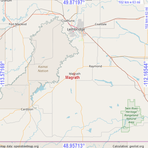
Magrath GPS coordinates[2]
49° 25' 0.048" North, 112° 52' 6.816" West
| Map corner | latitude | longitude |
|---|---|---|
| Upper-left | 49.87197°, | -113.57169° |
| Center: | 49.41668°, | -112.86856° |
| Lower-right: | 48.95713°, | -112.16544° |
| Map W x H: | 101.7×101.7 km | = 63.2×63.2mi |
| max Lat: | 73.03752° ⇑30.6% North |
| Magrath: | 49.41668° |
| min Lat: | ⇓69.4% South 42.05009° |
| min Long | Magrath | max Long |
| -139.43328° | -112.86856° | -52.70931° |
| W 22.3%⇐ | ⇒77.7% E |
Elevation
Elevation of Magrath is 980 m = 3215 ft, and this is 725.6 m = 2381 ft above average elevation for this country.
| Max E: |
1518 m = 4980 ft | 2.8% |
| Magrath | 980 m 3215 ft | |
| Avg. | 254.4 m = 835 ft | |
Min E: |
-2 m = -7 ft | 97.2% |
See also: Canada elevation on elevation.city.
Geographical zone
Magrath is located in North temperate zone (between Tropic of Cancer and the Arctic Circle). Distance of this North polar circle is 1906.6 km =1184.7 mi to North.| Distance of | km | miles | from Magrath |
|---|---|---|---|
| North Pole | 4512.4 | 2803.9 | to North |
| Arctic Circle | 1906.6 | 1184.7 | to North |
| Tropic Cancer | 2888.7 | 1795 | to South |
| Equator | 5494.6 | 3414.2 | to South |


Nearby cities:
15 places around Magrath: (largest is in red/bold)
• Bow Island
119 km =73.9 mi,  65°
65°
• Brooks
147.5 km =91.7 mi,  28°
28°
• Cardston
39.6 km =24.6 mi,  232°
232°
• Claresholm
85.8 km =53.3 mi,  323°
323°
• Coaldale
37.9 km =23.5 mi, 28°
• Coalhurst
36.9 km =22.9 mi,  352°
352°
• Fort Macleod
51.8 km =32.2 mi,  310°
310°
• Lethbridge
31.7 km =19.7 mi,  6°
6°
• Nanton
122.2 km =75.9 mi,  328°
328°
• Picture Butte
52.2 km =32.4 mi, 6°
• Pincher Creek
78.7 km =48.9 mi,  275°
275°
• Raymond
16.1 km =10 mi,  76°
76°
• Taber
66.4 km =41.3 mi,  51°
51°
• Vauxhall
90.2 km =56 mi,  36°
36°
• Vulcan
112.7 km =70 mi, 345°
Sources, notices
• [Note1] Compared only with cities in Canada existing in our database
• [Src1] Map data: © OpenStreetMap contributors (CC-BY-SA)
• [Src2] Other city data from geonames.org with taken over terms of usage.
• [Src3] Geographical zone / Annual Mean Temperature by Robert A. Rohde @ Wikipedia
