Mount Brydges geodata
Mount Brydges (Ontario) is a populated locality; located in Canada in America/Toronto (GMT-4) time zone. With population of 1,842 people, there are 782 cities with bigger population in this country. Compared to other cities in Canada, 98.2% of cities are located further ↑North; 60.8% of cities are located further →East and 63% of cities have lower elevation than Mount Brydges. Note1


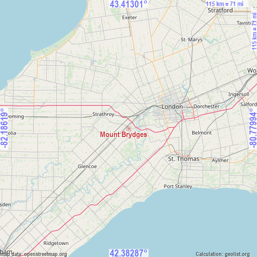
Mount Brydges GPS coordinates[2]
42° 54' 0.324" North, 81° 28' 59.016" West
| Map corner | latitude | longitude |
|---|---|---|
| Upper-left | 43.41301°, | -82.18619° |
| Center: | 42.90009°, | -81.48306° |
| Lower-right: | 42.38287°, | -80.77994° |
| Map W x H: | 114.5×114.5 km | = 71.1×71.1mi |
| max Lat: | 73.03752° ⇑98.2% North |
| Mount Brydges: | 42.90009° |
| min Lat: | ⇓1.8% South 42.05009° |
| min Long | Mount Brydges | max Long |
| -139.43328° | -81.48306° | -52.70931° |
| W 39.2%⇐ | ⇒60.8% E |
Elevation
Elevation of Mount Brydges is 246 m = 807 ft, and this is 8.4 m = 28 ft below average elevation for this country.
| Max E: |
1518 m = 4980 ft | 37% |
| Avg. | 254.4 m = 835 ft | |
| Mount Brydges | 246 m = 807 ft | |
Min E: |
-2 m = -7 ft | 63% |
See also: Canada elevation on elevation.city.
Geographical zone
Mount Brydges is located in North temperate zone (between Tropic of Cancer and the Arctic Circle). Distance of this Northern Tropic circle is 2164.1 km =1344.7 mi to South.| Distance of | km | miles | from Mount Brydges |
|---|---|---|---|
| North Pole | 5237 | 3254.1 | to North |
| Arctic Circle | 2631.1 | 1634.9 | to North |
| Tropic Cancer | 2164.1 | 1344.7 | to South |
| Equator | 4770 | 2963.9 | to South |


Nearby cities:
15 places around Mount Brydges: (largest is in red/bold)
• Aylmer
43.4 km =27 mi,  109°
109°
• Belmont
32.6 km =20.3 mi,  93°
93°
• Bothwell
43.1 km =26.8 mi,  226°
226°
• Delaware
5.7 km =3.5 mi,  71°
71°
• Dorchester
35.2 km =21.9 mi, 74°
• Glencoe
25.3 km =15.7 mi, 228°
• Lambton Shores
47.1 km =29.3 mi,  309°
309°
• London
22.4 km =13.9 mi, 65°
• Lucan
32.2 km =20 mi,  12°
12°
• Parkhill
33.2 km =20.6 mi,  330°
330°
• Port Stanley
33.9 km =21.1 mi,  140°
140°
• South Huron
46.4 km =28.8 mi,  356°
356°
• St. Thomas
28.4 km =17.6 mi,  119°
119°
• Watford
33 km =20.5 mi,  279°
279°
• West Lorne
34.7 km =21.6 mi,  195°
195°
Sources, notices
• [Note1] Compared only with cities in Canada existing in our database
• [Src1] Map data: © OpenStreetMap contributors (CC-BY-SA)
• [Src2] Other city data from geonames.org with taken over terms of usage.
• [Src3] Geographical zone / Annual Mean Temperature by Robert A. Rohde @ Wikipedia
