Nola geodata
Nola (Sangha-Mbaéré) is a seat of a first-order administrative division; located in Central African Republic in Africa/Bangui (GMT+1) time zone. With population of 26,809 people, there are 12 cities with bigger population in this country. Compared to other cities in Central African Republic, 100% of cities are located further ↑North; 85.7% of cities are located further →East and 85.7% of cities have higher elevation than Nola. Note1


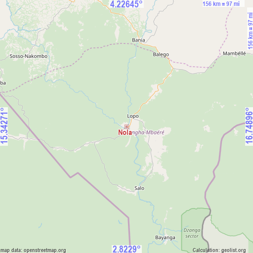
Nola GPS coordinates[2]
3° 31' 29.784" North, 16° 2' 44.988" East
| Map corner | latitude | longitude |
|---|---|---|
| Upper-left | 4.22645°, | 15.34271° |
| Center: | 3.52494°, | 16.04583° |
| Lower-right: | 2.8229°, | 16.74896° |
| Map W x H: | 156.1×156.1 km | = 97×97mi |
| max Lat: | 10.28488° ⇑100% North |
| Nola: | 3.52494° |
| min Lat: | ⇓0% South 3.52494° |
| min Long | Nola | max Long |
| 15.13926° | 16.04583° | 26.49211° |
| W 14.3%⇐ | ⇒85.7% E |
Elevation
Elevation of Nola is 386 m = 1266 ft, and this is 119.3 m = 391 ft below average elevation for this country.
| Max E: |
976 m = 3202 ft | 85.7% |
| Avg. | 505.3 m = 1658 ft | |
| Nola | 386 m = 1266 ft | |
Min E: |
351 m = 1152 ft | 14.3% |
See also: Central African Republic elevation on elevation.city.
Geographical zone
Nola is located in North Torrid zone (between Equator and Tropic of Cancer). Distance of Equator is 391.9 km =243.5 mi to South.| Distance of | km | miles | from Nola |
|---|---|---|---|
| North Pole | 9615.1 | 5974.5 | to North |
| Arctic Circle | 7009.2 | 4355.3 | to North |
| Tropic Cancer | 2214 | 1375.7 | to North |
| Equator | 391.9 | 243.5 | to South |


Nearby cities:
15 places around Nola: (largest is in red/bold)
• Bangui
293.4 km =182.3 mi,  71°
71°
• Baoro
238.3 km =148.1 mi,  357°
357°
• Berbérati
86.6 km =53.8 mi,  341°
341°
• Bimbo
275.2 km =171 mi, 72°
• Boali
270.9 km =168.3 mi,  58°
58°
• Boda
180.9 km =112.4 mi, 60°
• Bossangoa
365 km =226.8 mi,  25°
25°
• Bouar
272.5 km =169.3 mi,  349°
349°
• Bouca
413.5 km =256.9 mi,  36°
36°
• Bozoum
312.9 km =194.4 mi,  6°
6°
• Carnot
158.7 km =98.6 mi, 353°
• Damara
335.2 km =208.3 mi, 61°
• Gamboula
120.3 km =74.8 mi,  303°
303°
• Mbaïki
219 km =136.1 mi,  79°
79°
• Mongoumba
283 km =175.8 mi,  87°
87°
Sources, notices
• [Note1] Compared only with cities in Central African Republic existing in our database
• [Src1] Map data: © OpenStreetMap contributors (CC-BY-SA)
• [Src2] Other city data from geonames.org with taken over terms of usage.
• [Src3] Geographical zone / Annual Mean Temperature by Robert A. Rohde @ Wikipedia
