Sibiti geodata
Sibiti (Lékoumou) is a seat of a first-order administrative division; located in Republic of the Congo in Africa/Brazzaville (GMT+1) time zone. With population of 19,089 people, there are 10 cities with bigger population in this country. Compared to other cities in Republic of the Congo, 52.6% of cities are located further ↓South; 63.2% of cities are located further →East and 94.7% of cities have lower elevation than Sibiti. Note1


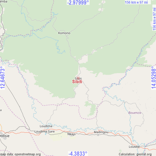
Sibiti GPS coordinates[2]
3° 40' 54.912" South, 13° 20' 59.46" East
| Map corner | latitude | longitude |
|---|---|---|
| Upper-left | -2.97999°, | 12.64673° |
| Center: | -3.68192°, | 13.34985° |
| Lower-right: | -4.3833°, | 14.05298° |
| Map W x H: | 156×156 km | = 96.9×96.9mi |
| max Lat: | 1.64806° ⇑47.4% North |
| Sibiti: | -3.68192° |
| min Lat: | ⇓52.6% South -4.77609° |
| min Long | Sibiti | max Long |
| 11.8125° | 13.34985° | 18.05981° |
| W 36.8%⇐ | ⇒63.2% E |
Elevation
Elevation of Sibiti is 531 m = 1742 ft, and this is 212 m = 696 ft above average elevation for this country.
| Max E: |
790 m = 2592 ft | 5.3% |
| Sibiti | 531 m 1742 ft | |
| Avg. | 319 m = 1047 ft | |
Min E: |
7 m = 23 ft | 94.7% |
See also: Republic of the Congo elevation on elevation.city.
Geographical zone
Sibiti is located in South Torrid zone (between Equator and Tropic of Capricorn). Distance of Equator is 409.4 km =254.4 mi to North.| Distance of | km | miles | from Sibiti |
|---|---|---|---|
| Equator | 409.4 | 254.4 | to North |
| Tropic Capricorn | 2196.5 | 1364.8 | to South |
| Antarctic Circle | 6991.8 | 4344.5 | to South |
| South Pole | 9597.7 | 5963.7 | to South |


Nearby cities:
14 places around Sibiti: (largest is in red/bold)
• Boukiéro
222.2 km =138.1 mi,  104°
104°
• Brazzaville
224.1 km =139.2 mi,  106°
106°
• Djambala
200.7 km =124.7 mi,  50°
50°
• Dolisie
95.1 km =59.1 mi,  232°
232°
• Ewo
352.5 km =219 mi,  27°
27°
• Gamboma
343.9 km =213.7 mi, 54°
• Kayes
58.6 km =36.4 mi,  186°
186°
• Kinkala
174.1 km =108.2 mi,  115°
115°
• Loandjili
204.1 km =126.8 mi, 234°
• Loango
201.7 km =125.3 mi,  237°
237°
• Madingou
57 km =35.4 mi,  157°
157°
• Mossendjo
108.5 km =67.4 mi,  318°
318°
• Nkayi
56.3 km =35 mi, 187°
• Pointe-Noire
204.9 km =127.3 mi, 233°
Sources, notices
• [Note1] Compared only with cities in Republic of the Congo existing in our database
• [Src1] Map data: © OpenStreetMap contributors (CC-BY-SA)
• [Src2] Other city data from geonames.org with taken over terms of usage.
• [Src3] Geographical zone / Annual Mean Temperature by Robert A. Rohde @ Wikipedia
