Madingou geodata
Madingou (Bouenza) is a seat of a first-order administrative division; located in Republic of the Congo in Africa/Brazzaville (GMT+1) time zone. With population of 22,760 people, there are 7 cities with bigger population in this country. Compared to other cities in Republic of the Congo, 52.6% of cities are located further ↑North; 57.9% of cities are located further →East and 73.7% of cities have higher elevation than Madingou. Note1


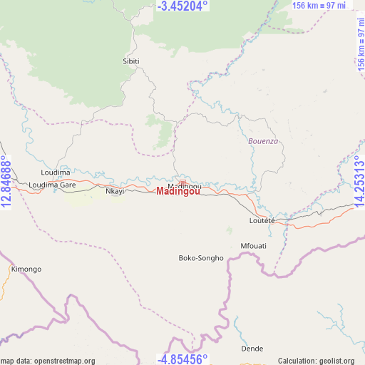
Madingou GPS coordinates[2]
4° 9' 12.996" South, 13° 33' 0" East
| Map corner | latitude | longitude |
|---|---|---|
| Upper-left | -3.45204°, | 12.84688° |
| Center: | -4.15361°, | 13.55° |
| Lower-right: | -4.85456°, | 14.25313° |
| Map W x H: | 155.9×155.9 km | = 96.9×96.9mi |
| max Lat: | 1.64806° ⇑52.6% North |
| Madingou: | -4.15361° |
| min Lat: | ⇓47.4% South -4.77609° |
| min Long | Madingou | max Long |
| 11.8125° | 13.55° | 18.05981° |
| W 42.1%⇐ | ⇒57.9% E |
Elevation
Elevation of Madingou is 216 m = 709 ft, and this is 103 m = 338 ft below average elevation for this country.
| Max E: |
790 m = 2592 ft | 73.7% |
| Avg. | 319 m = 1047 ft | |
| Madingou | 216 m = 709 ft | |
Min E: |
7 m = 23 ft | 26.3% |
See also: Republic of the Congo elevation on elevation.city.
Geographical zone
Madingou is located in South Torrid zone (between Equator and Tropic of Capricorn). Distance of Equator is 461.8 km =286.9 mi to North.| Distance of | km | miles | from Madingou |
|---|---|---|---|
| Equator | 461.8 | 286.9 | to North |
| Tropic Capricorn | 2144.1 | 1332.3 | to South |
| Antarctic Circle | 6939.3 | 4311.9 | to South |
| South Pole | 9545.2 | 5931.1 | to South |


Nearby cities:
14 places around Madingou: (largest is in red/bold)
• Boukiéro
192.5 km =119.6 mi,  91°
91°
• Brazzaville
192.6 km =119.7 mi, 93°
• Djambala
223.3 km =138.8 mi,  36°
36°
• Dolisie
98.1 km =61 mi,  267°
267°
• Ewo
391.2 km =243.1 mi,  21°
21°
• Gamboma
360.8 km =224.2 mi,  45°
45°
• Kayes
29.8 km =18.5 mi,  258°
258°
• Kinkala
136.6 km =84.9 mi,  99°
99°
• Loandjili
199.2 km =123.8 mi,  250°
250°
• Loango
200.4 km =124.5 mi, 253°
• Mossendjo
163.5 km =101.6 mi,  324°
324°
• Nkayi
29.5 km =18.3 mi, 263°
• Pointe-Noire
199.3 km =123.8 mi, 249°
• Sibiti
57 km =35.4 mi,  337°
337°
Sources, notices
• [Note1] Compared only with cities in Republic of the Congo existing in our database
• [Src1] Map data: © OpenStreetMap contributors (CC-BY-SA)
• [Src2] Other city data from geonames.org with taken over terms of usage.
• [Src3] Geographical zone / Annual Mean Temperature by Robert A. Rohde @ Wikipedia
