Nong’an geodata
Nong’an (Jilin) is a seat of a third-order administrative division; located in China in Asia/Shanghai (GMT+8) time zone. In our database, there are 1268 cities with bigger population. Compared to other cities in China, 93.3% of cities are located further ↓South; 94.8% of cities are located further ←West and 50.7% of cities have lower elevation than Nong’an. Note1


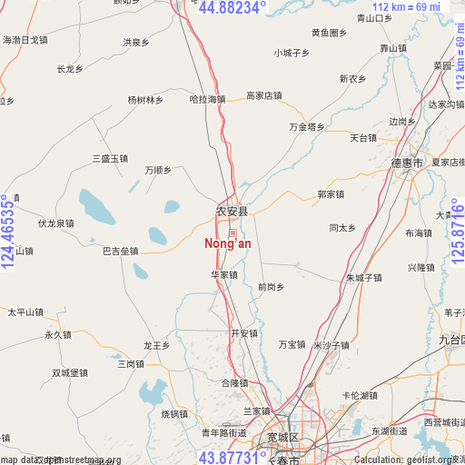
Nong’an GPS coordinates[2]
44° 22' 55.128" North, 125° 10' 6.492" East
| Map corner | latitude | longitude |
|---|---|---|
| Upper-left | 44.88234°, | 124.46535° |
| Center: | 44.38198°, | 125.16847° |
| Lower-right: | 43.87731°, | 125.8716° |
| Map W x H: | 111.7×111.7 km | = 69.4×69.4mi |
| max Lat: | 53.31946° ⇑6.7% North |
| Nong’an: | 44.38198° |
| min Lat: | ⇓93.3% South 18.22056° |
| min Long | Nong’an | max Long |
| 75.07348° | 125.16847° | 134.28917° |
| W 94.8%⇐ | ⇒5.2% E |
Elevation
Elevation of Nong’an is 171 m = 561 ft, and this is 313.8 m = 1030 ft below average elevation for this country.
| Max E: |
5622 m = 18445 ft | 49.3% |
| Avg. | 484.8 m = 1591 ft | |
| Nong’an | 171 m = 561 ft | |
Min E: |
-3 m = -10 ft | 50.7% |
See also: China elevation on elevation.city.
Geographical zone
Nong’an is located in North temperate zone (between Tropic of Cancer and the Arctic Circle). Distance of this Northern Tropic circle is 2328.9 km =1447.1 mi to South.| Distance of | km | miles | from Nong’an |
|---|---|---|---|
| North Pole | 5072.2 | 3151.7 | to North |
| Arctic Circle | 2466.4 | 1532.5 | to North |
| Tropic Cancer | 2328.9 | 1447.1 | to South |
| Equator | 4934.8 | 3066.3 | to South |


Nearby cities:
15 places around Nong’an: (largest is in red/bold)
• Changchun
57.2 km =35.5 mi,  167°
167°
• Changling
93.8 km =58.3 mi,  262°
262°
• Dehui
45.4 km =28.2 mi,  68°
68°
• Fuyu
93.3 km =58 mi,  342°
342°
• Gongzhuling
101.9 km =63.3 mi,  195°
195°
• Jilin
125.8 km =78.2 mi,  117°
117°
• Jiutai
58.7 km =36.5 mi, 115°
• Qian’an
111 km =69 mi,  307°
307°
• Sanchahe
93 km =57.8 mi,  46°
46°
• Shuangyang
103.6 km =64.4 mi,  157°
157°
• Songyuan
87.3 km =54.2 mi, 342°
• Xinglongshan
53 km =32.9 mi,  153°
153°
• Yitong
117.8 km =73.2 mi, 174°
• Yushu
117.6 km =73.1 mi, 66°
• Zhaoyuan
124.3 km =77.2 mi,  358°
358°
Sources, notices
• [Note1] Compared only with cities in China existing in our database
• [Src1] Map data: © OpenStreetMap contributors (CC-BY-SA)
• [Src2] Other city data from geonames.org with taken over terms of usage.
• [Src3] Geographical zone / Annual Mean Temperature by Robert A. Rohde @ Wikipedia
