Los Chiles geodata
Los Chiles (Alajuela) is a populated place; located in Costa Rica in America/Costa_Rica (GMT-6) time zone. With population of 3,342 people, there are 92 cities with bigger population in this country. Compared to other cities in Costa Rica, 99.3% of cities are located further ↓South; 82.8% of cities are located further →East and 86.6% of cities have higher elevation than Los Chiles. Note1


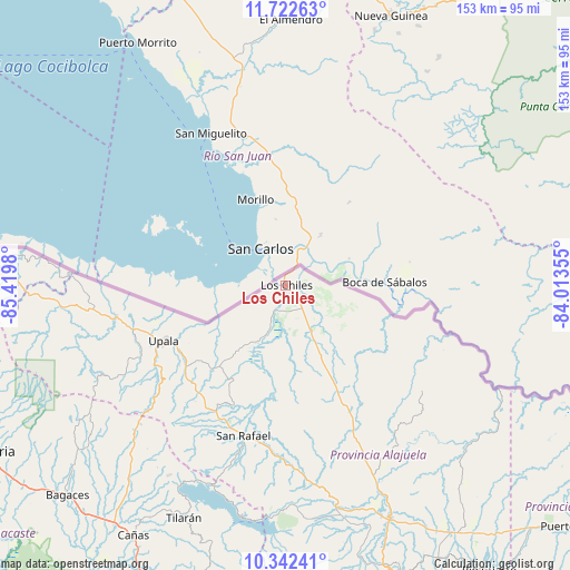
Los Chiles GPS coordinates[2]
11° 1' 59.988" North, 84° 43' 0.012" West
| Map corner | latitude | longitude |
|---|---|---|
| Upper-left | 11.72263°, | -85.4198° |
| Center: | 11.03333°, | -84.71667° |
| Lower-right: | 10.34241°, | -84.01355° |
| Map W x H: | 153.5×153.5 km | = 95.4×95.4mi |
| max Lat: | 11.07377° ⇑0.7% North |
| Los Chiles: | 11.03333° |
| min Lat: | ⇓99.3% South 8.53305° |
| min Long | Los Chiles | max Long |
| -85.64748° | -84.71667° | -82.62185° |
| W 17.2%⇐ | ⇒82.8% E |
Elevation
Elevation of Los Chiles is 42 m = 138 ft, and this is 693 m = 2274 ft below average elevation for this country.
| Max E: |
1844 m = 6050 ft | 86.6% |
| Avg. | 735 m = 2411 ft | |
| Los Chiles | 42 m = 138 ft | |
Min E: |
7 m = 23 ft | 13.4% |
See also: Costa Rica elevation on elevation.city.
Geographical zone
Los Chiles is located in North Torrid zone (between Equator and Tropic of Cancer). Distance of Equator is 1226.8 km =762.3 mi to South.| Distance of | km | miles | from Los Chiles |
|---|---|---|---|
| North Pole | 8780.3 | 5455.8 | to North |
| Arctic Circle | 6174.4 | 3836.6 | to North |
| Tropic Cancer | 1379.1 | 856.9 | to North |
| Equator | 1226.8 | 762.3 | to South |


Nearby cities:
15 places around Los Chiles: (largest is in red/bold)
• Bagaces
81.6 km =50.7 mi,  226°
226°
• Bijagua
50 km =31.1 mi, 228°
• Cañas
78.9 km =49 mi,  211°
211°
• Florencia
79.3 km =49.3 mi,  160°
160°
• Fortuna
66.2 km =41.1 mi, 232°
• Juntas
87.8 km =54.6 mi,  197°
197°
• La Fortuna
63 km =39.1 mi,  172°
172°
• La Virgen
94.8 km =58.9 mi,  137°
137°
• Liberia
90.3 km =56.1 mi,  240°
240°
• Pital
80.8 km =50.2 mi, 143°
• Pocosol
74.9 km =46.5 mi, 171°
• Quesada
85 km =52.8 mi, 158°
• San José
46.7 km =29 mi,  258°
258°
• Tilarán
68.7 km =42.7 mi, 203°
• Upala
35.8 km =22.2 mi,  245°
245°
Sources, notices
• [Note1] Compared only with cities in Costa Rica existing in our database
• [Src1] Map data: © OpenStreetMap contributors (CC-BY-SA)
• [Src2] Other city data from geonames.org with taken over terms of usage.
• [Src3] Geographical zone / Annual Mean Temperature by Robert A. Rohde @ Wikipedia
