Sidi Amrane geodata
Sidi Amrane (Ouargla) is a populated place; located in Algeria in Africa/Algiers (GMT+1) time zone. With population of 29,734 people, there are 175 cities with bigger population in this country. Compared to other cities in Algeria, 90.3% of cities are located further ↑North; 79.8% of cities are located further ←West and 88.8% of cities have higher elevation than Sidi Amrane. Note1


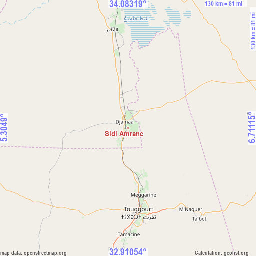
Sidi Amrane GPS coordinates[2]
33° 29' 55.86" North, 6° 0' 28.908" East
| Map corner | latitude | longitude |
|---|---|---|
| Upper-left | 34.08319°, | 5.3049° |
| Center: | 33.49885°, | 6.00803° |
| Lower-right: | 32.91054°, | 6.71115° |
| Map W x H: | 130.4×130.4 km | = 81×81mi |
| max Lat: | 36.92917° ⇑90.3% North |
| Sidi Amrane: | 33.49885° |
| min Lat: | ⇓9.7% South 22.785° |
| min Long | Sidi Amrane | max Long |
| -8.14743° | 6.00803° | 8.46667° |
| W 79.8%⇐ | ⇒20.2% E |
Elevation
Elevation of Sidi Amrane is 45 m = 148 ft, and this is 393.5 m = 1291 ft below average elevation for this country.
| Max E: |
1392 m = 4567 ft | 88.8% |
| Avg. | 438.5 m = 1439 ft | |
| Sidi Amrane | 45 m = 148 ft | |
Min E: |
5 m = 16 ft | 11.2% |
See also: Algeria elevation on elevation.city.
Geographical zone
Sidi Amrane is located in North temperate zone (between Tropic of Cancer and the Arctic Circle). Distance of this Northern Tropic circle is 1118.8 km =695.2 mi to South.| Distance of | km | miles | from Sidi Amrane |
|---|---|---|---|
| North Pole | 6282.3 | 3903.6 | to North |
| Arctic Circle | 3676.5 | 2284.5 | to North |
| Tropic Cancer | 1118.8 | 695.2 | to South |
| Equator | 3724.7 | 2314.4 | to South |


Nearby cities:
15 places around Sidi Amrane: (largest is in red/bold)
• Biskra
152.5 km =94.8 mi,  350°
350°
• Debila
87.4 km =54.3 mi,  88°
88°
• Djamaa
4.1 km =2.5 mi,  340°
340°
• El Hadjira
108.7 km =67.5 mi,  205°
205°
• El Oued
80.9 km =50.3 mi,  101°
101°
• Megarine
34.9 km =21.7 mi,  167°
167°
• Oumache
136.1 km =84.6 mi, 347°
• Reguiba
64.8 km =40.3 mi,  83°
83°
• Robbah
87.2 km =54.2 mi,  106°
106°
• Sidi Khaled
136.4 km =84.8 mi,  316°
316°
• Sidi Okba
138.9 km =86.3 mi,  355°
355°
• Tebesbest
43.1 km =26.8 mi, 170°
• Tolga
147.9 km =91.9 mi, 336°
• Touggourt
44 km =27.3 mi, 173°
• Zeribet el Oued
139.6 km =86.7 mi,  19°
19°
Sources, notices
• [Note1] Compared only with cities in Algeria existing in our database
• [Src1] Map data: © OpenStreetMap contributors (CC-BY-SA)
• [Src2] Other city data from geonames.org with taken over terms of usage.
• [Src3] Geographical zone / Annual Mean Temperature by Robert A. Rohde @ Wikipedia
