Reguiba geodata
Reguiba (El Oued) is a populated place; located in Algeria in Africa/Algiers (GMT+1) time zone. With population of 62,185 people, there are 75 cities with bigger population in this country. Compared to other cities in Algeria, 89.1% of cities are located further ↑North; 88.4% of cities are located further ←West and 84.9% of cities have higher elevation than Reguiba. Note1


Reguiba GPS coordinates[2]
33° 33' 50.076" North, 6° 42' 11.736" East
| Map corner | latitude | longitude |
|---|---|---|
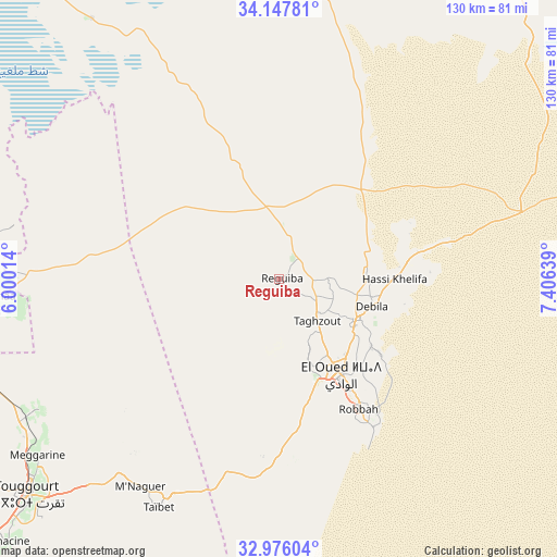
| Upper-left | 34.14781°, | 6.00014° |
| Center: | 33.56391°, | 6.70326° |
| Lower-right: | 32.97604°, | 7.40639° |
| Map W x H: | 130.3×130.3 km | = 81×81mi |
| max Lat: | 36.92917° ⇑89.1% North |
| Reguiba: | 33.56391° |
| min Lat: | ⇓10.9% South 22.785° |
| min Long | Reguiba | max Long |
| -8.14743° | 6.70326° | 8.46667° |
| W 88.4%⇐ | ⇒11.6% E |
Elevation
Elevation of Reguiba is 58 m = 190 ft, and this is 380.5 m = 1248 ft below average elevation for this country.
| Max E: |
1392 m = 4567 ft | 84.9% |
| Avg. | 438.5 m = 1439 ft | |
| Reguiba | 58 m = 190 ft | |
Min E: |
5 m = 16 ft | 15.1% |
See also: Reguiba elevation on elevation.city.
Geographical zone
Reguiba is located in North temperate zone (between Tropic of Cancer and the Arctic Circle). Distance of this Northern Tropic circle is 1126 km =699.7 mi to South.| Distance of | km | miles | from Reguiba |
|---|---|---|---|
| North Pole | 6275.1 | 3899.2 | to North |
| Arctic Circle | 3669.2 | 2279.9 | to North |
| Tropic Cancer | 1126 | 699.7 | to South |
| Equator | 3732 | 2319 | to South |


Nearby cities:
15 places around Reguiba: (largest is in red/bold)
• Bir el Ater
181.2 km =112.6 mi,  43°
43°
• Biskra
168.8 km =104.9 mi,  327°
327°
• Debila
23.5 km =14.6 mi,  102°
102°
• Djamaa
65.9 km =40.9 mi,  267°
267°
• El Hadjira
153.2 km =95.2 mi,  226°
226°
• El Oued
27.5 km =17.1 mi,  147°
147°
• Megarine
70.6 km =43.9 mi, 234°
• Oumache
156.9 km =97.5 mi,  323°
323°
• Robbah
37 km =23 mi, 148°
• Sidi Amrane
64.8 km =40.3 mi,  263°
263°
• Sidi Okba
150.8 km =93.7 mi, 330°
• Tebesbest
76.1 km =47.3 mi, 229°
• Tolga
177.3 km =110.2 mi, 316°
• Touggourt
78.7 km =48.9 mi, 229°
• Zeribet el Oued
125.7 km =78.1 mi,  351°
351°
Sources, notices
• [Note1] Compared only with cities in Algeria existing in our database
• [Src1] Map data: © OpenStreetMap contributors (CC-BY-SA)
• [Src2] Other city data from geonames.org with taken over terms of usage.
• [Src3] Geographical zone / Annual Mean Temperature by Robert A. Rohde @ Wikipedia
