Zeribet el Oued geodata
Zeribet el Oued (Biskra) is a populated place; located in Algeria in Africa/Algiers (GMT+1) time zone. With population of 23,187 people, there are 209 cities with bigger population in this country. Compared to other cities in Algeria, 84.9% of cities are located further ↑North; 85.3% of cities are located further ←West and 88% of cities have higher elevation than Zeribet el Oued. Note1


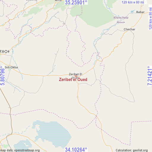
Zeribet el Oued GPS coordinates[2]
34° 40' 58.224" North, 6° 30' 39.924" East
| Map corner | latitude | longitude |
|---|---|---|
| Upper-left | 35.25901°, | 5.80796° |
| Center: | 34.68284°, | 6.51109° |
| Lower-right: | 34.10264°, | 7.21421° |
| Map W x H: | 128.6×128.6 km | = 79.9×79.9mi |
| max Lat: | 36.92917° ⇑84.9% North |
| Zeribet el Oued: | 34.68284° |
| min Lat: | ⇓15.1% South 22.785° |
| min Long | Zeribet el Oued | max Long |
| -8.14743° | 6.51109° | 8.46667° |
| W 85.3%⇐ | ⇒14.7% E |
Elevation
Elevation of Zeribet el Oued is 47 m = 154 ft, and this is 391.5 m = 1284 ft below average elevation for this country.
| Max E: |
1392 m = 4567 ft | 88% |
| Avg. | 438.5 m = 1439 ft | |
| Zeribet el Oued | 47 m = 154 ft | |
Min E: |
5 m = 16 ft | 12% |
See also: Algeria elevation on elevation.city.
Geographical zone
Zeribet el Oued is located in North temperate zone (between Tropic of Cancer and the Arctic Circle). Distance of this Northern Tropic circle is 1250.5 km =777 mi to South.| Distance of | km | miles | from Zeribet el Oued |
|---|---|---|---|
| North Pole | 6150.7 | 3821.9 | to North |
| Arctic Circle | 3544.8 | 2202.6 | to North |
| Tropic Cancer | 1250.5 | 777 | to South |
| Equator | 3856.4 | 2396.3 | to South |


Nearby cities:
15 places around Zeribet el Oued: (largest is in red/bold)
• Arris
65.8 km =40.9 mi,  346°
346°
• Aïn Touta
95.1 km =59.1 mi,  324°
324°
• Barika
130.5 km =81.1 mi,  306°
306°
• Batna
101.8 km =63.3 mi,  342°
342°
• Biskra
73.9 km =45.9 mi,  284°
284°
• Boumagueur
126.4 km =78.5 mi, 316°
• Cheria
130.7 km =81.2 mi,  59°
59°
• Khenchela
101.6 km =63.1 mi,  34°
34°
• Merouana
118.7 km =73.8 mi,  332°
332°
• Oumache
75.9 km =47.2 mi,  270°
270°
• Reguiba
125.7 km =78.1 mi,  171°
171°
• Râs el Aïoun
135.4 km =84.1 mi, 324°
• Sidi Okba
56.4 km =35 mi, 277°
• Tazoult-Lambese
91.7 km =57 mi, 345°
• Tolga
103.6 km =64.4 mi, 272°
Sources, notices
• [Note1] Compared only with cities in Algeria existing in our database
• [Src1] Map data: © OpenStreetMap contributors (CC-BY-SA)
• [Src2] Other city data from geonames.org with taken over terms of usage.
• [Src3] Geographical zone / Annual Mean Temperature by Robert A. Rohde @ Wikipedia
