Hassi Messaoud geodata
Hassi Messaoud (Ouargla) is a populated place; located in Algeria in Africa/Algiers (GMT+1) time zone. With population of 53,000 people, there are 91 cities with bigger population in this country. Compared to other cities in Algeria, 96.5% of cities are located further ↑North; 81% of cities are located further ←West and 64% of cities have higher elevation than Hassi Messaoud. Note1


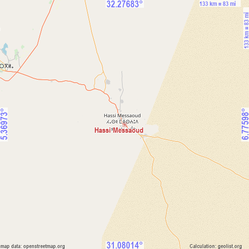
Hassi Messaoud GPS coordinates[2]
31° 40' 49.476" North, 6° 4' 22.296" East
| Map corner | latitude | longitude |
|---|---|---|
| Upper-left | 32.27683°, | 5.36973° |
| Center: | 31.68041°, | 6.07286° |
| Lower-right: | 31.08014°, | 6.77598° |
| Map W x H: | 133.1×133.1 km | = 82.7×82.7mi |
| max Lat: | 36.92917° ⇑96.5% North |
| Hassi Messaoud: | 31.68041° |
| min Lat: | ⇓3.5% South 22.785° |
| min Long | Hassi Messaoud | max Long |
| -8.14743° | 6.07286° | 8.46667° |
| W 81%⇐ | ⇒19% E |
Elevation
Elevation of Hassi Messaoud is 152 m = 499 ft, and this is 286.5 m = 940 ft below average elevation for this country.
| Max E: |
1392 m = 4567 ft | 64% |
| Avg. | 438.5 m = 1439 ft | |
| Hassi Messaoud | 152 m = 499 ft | |
Min E: |
5 m = 16 ft | 36% |
See also: Hassi Messaoud elevation on elevation.city.
Geographical zone
Hassi Messaoud is located in North temperate zone (between Tropic of Cancer and the Arctic Circle). Distance of this Northern Tropic circle is 916.6 km =569.5 mi to South.| Distance of | km | miles | from Hassi Messaoud |
|---|---|---|---|
| North Pole | 6484.5 | 4029.3 | to North |
| Arctic Circle | 3878.6 | 2410 | to North |
| Tropic Cancer | 916.6 | 569.5 | to South |
| Equator | 3522.5 | 2188.8 | to South |


Nearby cities:
15 places around Hassi Messaoud: (largest is in red/bold)
• Berriane
251.5 km =156.3 mi,  300°
300°
• Debila
220.1 km =136.8 mi,  21°
21°
• Djamaa
206.2 km =128.1 mi,  357°
357°
• El Hadjira
116.4 km =72.3 mi,  333°
333°
• El Oued
200.5 km =124.6 mi, 21°
• Ghardaïa
243.3 km =151.2 mi,  291°
291°
• Megarine
168.1 km =104.5 mi,  0°
0°
• Metlili Chaamba
239.1 km =148.6 mi, 285°
• Ouargla
76.7 km =47.7 mi, 292°
• Reguiba
217.6 km =135.2 mi, 15°
• Robbah
194.4 km =120.8 mi, 23°
• Rouissat
73.5 km =45.7 mi, 291°
• Sidi Amrane
202.3 km =125.7 mi, 358°
• Tebesbest
159.7 km =99.2 mi, 0°
• Touggourt
158.4 km =98.4 mi, 359°
Sources, notices
• [Note1] Compared only with cities in Algeria existing in our database
• [Src1] Map data: © OpenStreetMap contributors (CC-BY-SA)
• [Src2] Other city data from geonames.org with taken over terms of usage.
• [Src3] Geographical zone / Annual Mean Temperature by Robert A. Rohde @ Wikipedia
