‘Aïn el Hadjel geodata
‘Aïn el Hadjel (M'Sila) is a populated place; located in Algeria in Africa/Algiers (GMT+1) time zone. With population of 42,527 people, there are 118 cities with bigger population in this country. Compared to other cities in Algeria, 62.4% of cities are located further ↑North; 55.4% of cities are located further ←West and 63.6% of cities have lower elevation than ‘Aïn el Hadjel. Note1


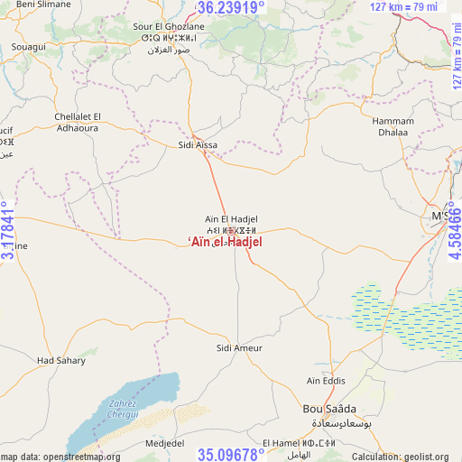
‘Aïn el Hadjel GPS coordinates[2]
35° 40' 12.108" North, 3° 52' 53.508" East
| Map corner | latitude | longitude |
|---|---|---|
| Upper-left | 36.23919°, | 3.17841° |
| Center: | 35.67003°, | 3.88153° |
| Lower-right: | 35.09678°, | 4.58466° |
| Map W x H: | 127×127 km | = 78.9×78.9mi |
| max Lat: | 36.92917° ⇑62.4% North |
| ‘Aïn el Hadjel: | 35.67003° |
| min Lat: | ⇓37.6% South 22.785° |
| min Long | ‘Aïn el Hadj | max Long |
| -8.14743° | 3.88153° | 8.46667° |
| W 55.4%⇐ | ⇒44.6% E |
Elevation
Elevation of ‘Aïn el Hadjel is 544 m = 1785 ft, and this is 105.5 m = 346 ft above average elevation for this country.
| Max E: |
1392 m = 4567 ft | 36.4% |
| ‘Aïn el Hadjel | 544 m 1785 ft | |
| Avg. | 438.5 m = 1439 ft | |
Min E: |
5 m = 16 ft | 63.6% |
See also: ‘Aïn el Hadjel elevation on elevation.city.
Geographical zone
‘Aïn el Hadjel is located in North temperate zone (between Tropic of Cancer and the Arctic Circle). Distance of this Northern Tropic circle is 1360.2 km =845.2 mi to South.| Distance of | km | miles | from ‘Aïn el Hadjel |
|---|---|---|---|
| North Pole | 6040.9 | 3753.6 | to North |
| Arctic Circle | 3435 | 2134.4 | to North |
| Tropic Cancer | 1360.2 | 845.2 | to South |
| Equator | 3966.1 | 2464.4 | to South |


Nearby cities:
15 places around ‘Aïn el Hadjel: (largest is in red/bold)
• Aïn Bessem
71.8 km =44.6 mi,  344°
344°
• Aïn Oussera
91.5 km =56.9 mi,  254°
254°
• Birine
59.4 km =36.9 mi,  266°
266°
• Bordj Bou Arreridj
91 km =56.5 mi,  60°
60°
• Bordj Ghdir
95.2 km =59.2 mi,  74°
74°
• Bouïra
78.4 km =48.7 mi,  1°
1°
• Chorfa
87 km =54.1 mi,  27°
27°
• Dar Chioukh
93.2 km =57.9 mi,  202°
202°
• El Achir
80.2 km =49.8 mi, 56°
• Mansourah
69.2 km =43 mi,  47°
47°
• Melouza
44.1 km =27.4 mi,  38°
38°
• M’Sila
59.8 km =37.2 mi,  86°
86°
• Sidi Aïssa
25.9 km =16.1 mi, 337°
• Sour el Ghozlane
55.8 km =34.7 mi, 342°
• ’Aïn Boucif
69.7 km =43.3 mi,  290°
290°
Sources, notices
• [Note1] Compared only with cities in Algeria existing in our database
• [Src1] Map data: © OpenStreetMap contributors (CC-BY-SA)
• [Src2] Other city data from geonames.org with taken over terms of usage.
• [Src3] Geographical zone / Annual Mean Temperature by Robert A. Rohde @ Wikipedia
