Dar Chioukh geodata
Dar Chioukh (Djelfa) is a populated place; located in Algeria in Africa/Algiers (GMT+1) time zone. With population of 54,022 people, there are 89 cities with bigger population in this country. Compared to other cities in Algeria, 79.5% of cities are located further ↑North; 50.4% of cities are located further →East and 94.2% of cities have lower elevation than Dar Chioukh. Note1


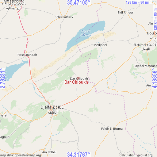
Dar Chioukh GPS coordinates[2]
34° 53' 46.968" North, 3° 29' 7.548" East
| Map corner | latitude | longitude |
|---|---|---|
| Upper-left | 35.47105°, | 2.78231° |
| Center: | 34.89638°, | 3.48543° |
| Lower-right: | 34.31767°, | 4.18856° |
| Map W x H: | 128.2×128.2 km | = 79.7×79.7mi |
| max Lat: | 36.92917° ⇑79.5% North |
| Dar Chioukh: | 34.89638° |
| min Lat: | ⇓20.5% South 22.785° |
| min Long | Dar Chioukh | max Long |
| -8.14743° | 3.48543° | 8.46667° |
| W 49.6%⇐ | ⇒50.4% E |
Elevation
Elevation of Dar Chioukh is 1094 m = 3589 ft, and this is 655.5 m = 2151 ft above average elevation for this country.
| Max E: |
1392 m = 4567 ft | 5.8% |
| Dar Chioukh | 1094 m 3589 ft | |
| Avg. | 438.5 m = 1439 ft | |
Min E: |
5 m = 16 ft | 94.2% |
See also: Dar Chioukh elevation on elevation.city.
Geographical zone
Dar Chioukh is located in North temperate zone (between Tropic of Cancer and the Arctic Circle). Distance of this Northern Tropic circle is 1274.2 km =791.8 mi to South.| Distance of | km | miles | from Dar Chioukh |
|---|---|---|---|
| North Pole | 6126.9 | 3807.1 | to North |
| Arctic Circle | 3521.1 | 2187.9 | to North |
| Tropic Cancer | 1274.2 | 791.8 | to South |
| Equator | 3880.1 | 2411 | to South |


Nearby cities:
15 places around Dar Chioukh: (largest is in red/bold)
• Aïn Oussera
81.1 km =50.4 mi,  319°
319°
• Birine
85.5 km =53.1 mi,  343°
343°
• Charef
70.1 km =43.6 mi,  244°
244°
• Djelfa
32.1 km =19.9 mi,  219°
219°
• El Idrissia
100.9 km =62.7 mi, 240°
• Ksar Chellala
111.8 km =69.5 mi,  288°
288°
• Ksar el Boukhari
129 km =80.2 mi,  328°
328°
• Laghouat
134.5 km =83.6 mi,  205°
205°
• Messaad
82.5 km =51.3 mi,  178°
178°
• M’Sila
131.5 km =81.7 mi,  46°
46°
• Sidi Aïssa
113 km =70.2 mi,  13°
13°
• ‘Aïn el Hadjel
93.2 km =57.9 mi,  22°
22°
• ’Aïn Boucif
114.5 km =71.1 mi,  345°
345°
• ’Aïn el Bell
65.9 km =40.9 mi,  201°
201°
• ’Aïn el Melh
62.2 km =38.6 mi,  95°
95°
Sources, notices
• [Note1] Compared only with cities in Algeria existing in our database
• [Src1] Map data: © OpenStreetMap contributors (CC-BY-SA)
• [Src2] Other city data from geonames.org with taken over terms of usage.
• [Src3] Geographical zone / Annual Mean Temperature by Robert A. Rohde @ Wikipedia
