Aflou geodata
Aflou (Laghouat) is a populated place; located in Algeria in Africa/Algiers (GMT+1) time zone. With population of 84,683 people, there are 46 cities with bigger population in this country. Compared to other cities in Algeria, 88% of cities are located further ↑North; 70.9% of cities are located further →East and 100% of cities have lower elevation than Aflou. Note1


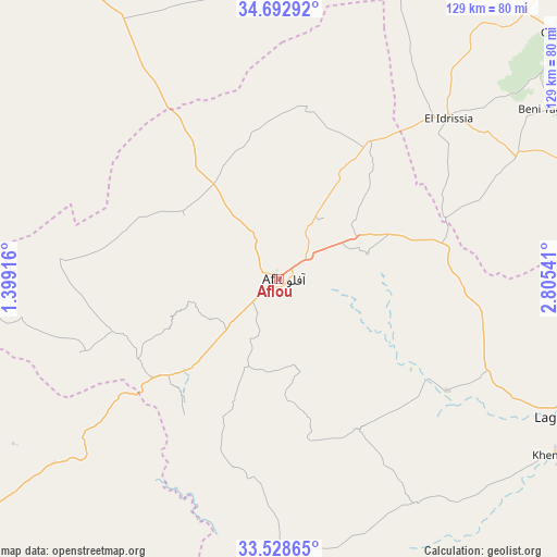
Aflou GPS coordinates[2]
34° 6' 46.044" North, 2° 6' 8.208" East
| Map corner | latitude | longitude |
|---|---|---|
| Upper-left | 34.69292°, | 1.39916° |
| Center: | 34.11279°, | 2.10228° |
| Lower-right: | 33.52865°, | 2.80541° |
| Map W x H: | 129.5×129.5 km | = 80.5×80.5mi |
| max Lat: | 36.92917° ⇑88% North |
| Aflou: | 34.11279° |
| min Lat: | ⇓12% South 22.785° |
| min Long | Aflou | max Long |
| -8.14743° | 2.10228° | 8.46667° |
| W 29.1%⇐ | ⇒70.9% E |
Elevation
Elevation of Aflou is 1392 m = 4567 ft, and this is 953.5 m = 3128 ft above average elevation for this country.
| Max E: |
1392 m = 4567 ft | 0% |
| Aflou | 1392 m 4567 ft | |
| Avg. | 438.5 m = 1439 ft | |
Min E: |
5 m = 16 ft | 100% |
See also: Aflou elevation on elevation.city.
Geographical zone
Aflou is located in North temperate zone (between Tropic of Cancer and the Arctic Circle). Distance of this Northern Tropic circle is 1187.1 km =737.6 mi to South.| Distance of | km | miles | from Aflou |
|---|---|---|---|
| North Pole | 6214.1 | 3861.3 | to North |
| Arctic Circle | 3608.2 | 2242 | to North |
| Tropic Cancer | 1187.1 | 737.6 | to South |
| Equator | 3793 | 2356.9 | to South |


Nearby cities:
15 places around Aflou: (largest is in red/bold)
• Brezina
137 km =85.1 mi,  214°
214°
• Charef
85.1 km =52.9 mi,  48°
48°
• Dar Chioukh
153.8 km =95.6 mi,  55°
55°
• Djebilet Rosfa
143 km =88.9 mi,  305°
305°
• Djelfa
123.4 km =76.7 mi, 59°
• El Bayadh
110.8 km =68.8 mi,  244°
244°
• El Idrissia
53.8 km =33.4 mi, 46°
• Frenda
143.2 km =89 mi,  317°
317°
• Ksar Chellala
123.8 km =76.9 mi,  9°
9°
• Laghouat
78.5 km =48.8 mi,  116°
116°
• Mehdia daira de meghila
149.9 km =93.1 mi,  347°
347°
• Messaad
129 km =80.2 mi,  87°
87°
• Sougueur
131.5 km =81.7 mi,  335°
335°
• ’Aïn Deheb
95.7 km =59.5 mi,  327°
327°
• ’Aïn el Bell
106.3 km =66.1 mi,  76°
76°
Sources, notices
• [Note1] Compared only with cities in Algeria existing in our database
• [Src1] Map data: © OpenStreetMap contributors (CC-BY-SA)
• [Src2] Other city data from geonames.org with taken over terms of usage.
• [Src3] Geographical zone / Annual Mean Temperature by Robert A. Rohde @ Wikipedia
