Djebilet Rosfa geodata
Djebilet Rosfa (Tiaret) is a populated locality; located in Algeria in Africa/Algiers (GMT+1) time zone. With population of 4,930 people, there are 254 cities with bigger population in this country. Compared to other cities in Algeria, 80.6% of cities are located further ↑North; 81.4% of cities are located further →East and 82.9% of cities have lower elevation than Djebilet Rosfa. Note1


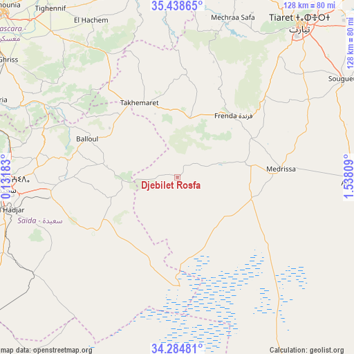
Djebilet Rosfa GPS coordinates[2]
34° 51' 49.5" North, 0° 50' 5.856" East
| Map corner | latitude | longitude |
|---|---|---|
| Upper-left | 35.43865°, | 0.13183° |
| Center: | 34.86375°, | 0.83496° |
| Lower-right: | 34.28481°, | 1.53809° |
| Map W x H: | 128.3×128.3 km | = 79.7×79.7mi |
| max Lat: | 36.92917° ⇑80.6% North |
| Djebilet Rosfa: | 34.86375° |
| min Lat: | ⇓19.4% South 22.785° |
| min Long | Djebilet Rosfa | max Long |
| -8.14743° | 0.83496° | 8.46667° |
| W 18.6%⇐ | ⇒81.4% E |
Elevation
Elevation of Djebilet Rosfa is 905 m = 2969 ft, and this is 466.5 m = 1531 ft above average elevation for this country.
| Max E: |
1392 m = 4567 ft | 17.1% |
| Djebilet Rosfa | 905 m 2969 ft | |
| Avg. | 438.5 m = 1439 ft | |
Min E: |
5 m = 16 ft | 82.9% |
See also: Algeria elevation on elevation.city.
Geographical zone
Djebilet Rosfa is located in North temperate zone (between Tropic of Cancer and the Arctic Circle). Distance of this Northern Tropic circle is 1270.6 km =789.5 mi to South.| Distance of | km | miles | from Djebilet Rosfa |
|---|---|---|---|
| North Pole | 6130.6 | 3809.4 | to North |
| Arctic Circle | 3524.7 | 2190.1 | to North |
| Tropic Cancer | 1270.6 | 789.5 | to South |
| Equator | 3876.5 | 2408.7 | to South |


Nearby cities:
15 places around Djebilet Rosfa: (largest is in red/bold)
• Bou Hanifia el Hamamat
94.9 km =59 mi,  301°
301°
• Frenda
29.7 km =18.5 mi,  41°
41°
• Mascara
86.6 km =53.8 mi,  313°
313°
• Mehdia daira de meghila
104.9 km =65.2 mi,  53°
53°
• Oued el Abtal
67.2 km =41.8 mi,  348°
348°
• Relizane
100.4 km =62.4 mi, 345°
• Rouachdia
94.4 km =58.7 mi, 354°
• Saïda
62.5 km =38.8 mi,  266°
266°
• Sfizef
106.5 km =66.2 mi,  292°
292°
• Smala
95.1 km =59.1 mi,  355°
355°
• Sougueur
70 km =43.5 mi,  59°
59°
• Tiaret
71.4 km =44.4 mi, 37°
• Zemoura
95.8 km =59.5 mi, 355°
• ’Aïn Deheb
65 km =40.4 mi,  92°
92°
• ’Aïn el Hadjar
64 km =39.8 mi,  259°
259°
Sources, notices
• [Note1] Compared only with cities in Algeria existing in our database
• [Src1] Map data: © OpenStreetMap contributors (CC-BY-SA)
• [Src2] Other city data from geonames.org with taken over terms of usage.
• [Src3] Geographical zone / Annual Mean Temperature by Robert A. Rohde @ Wikipedia
