Ras Gharib geodata
Ras Gharib (Red Sea) is a populated place; located in Egypt in Africa/Cairo (GMT+2) time zone. With population of 32,000 people, there are 117 cities with bigger population in this country. Compared to other cities in Egypt, 70.3% of cities are located further ↑North; 89.1% of cities are located further ←West and 55.1% of cities have higher elevation than Ras Gharib. Note1


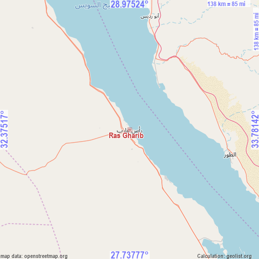
Ras Gharib GPS coordinates[2]
28° 21' 29.916" North, 33° 4' 41.844" East
| Map corner | latitude | longitude |
|---|---|---|
| Upper-left | 28.97524°, | 32.37517° |
| Center: | 28.35831°, | 33.07829° |
| Lower-right: | 27.73777°, | 33.78142° |
| Map W x H: | 137.6×137.6 km | = 85.5×85.5mi |
| max Lat: | 31.5084° ⇑70.3% North |
| Ras Gharib: | 28.35831° |
| min Lat: | ⇓29.7% South 22.3457° |
| min Long | Ras Gharib | max Long |
| 25.51965° | 33.07829° | 34.89572° |
| W 89.1%⇐ | ⇒10.9% E |
Elevation
Elevation of Ras Gharib is 16 m = 52 ft, and this is 27.5 m = 90 ft below average elevation for this country.
| Max E: |
1565 m = 5135 ft | 55.1% |
| Avg. | 43.5 m = 143 ft | |
| Ras Gharib | 16 m = 52 ft | |
Min E: |
-15 m = -49 ft | 44.9% |
See also: Egypt elevation on elevation.city.
Geographical zone
Ras Gharib is located in North temperate zone (between Tropic of Cancer and the Arctic Circle). Distance of this Northern Tropic circle is 547.2 km =340 mi to South.| Distance of | km | miles | from Ras Gharib |
|---|---|---|---|
| North Pole | 6853.9 | 4258.8 | to North |
| Arctic Circle | 4248 | 2639.6 | to North |
| Tropic Cancer | 547.2 | 340 | to South |
| Equator | 3153.1 | 1959.2 | to South |


Nearby cities:
15 places around Ras Gharib: (largest is in red/bold)
• Ain Sukhna
156.7 km =97.4 mi,  331°
331°
• Al Wāsiţah
212.4 km =132 mi,  300°
300°
• Banī Suwayf
208.9 km =129.8 mi,  292°
292°
• Būsh
209.5 km =130.2 mi, 294°
• Dahab
139.2 km =86.5 mi,  84°
84°
• El Gouna
122.3 km =76 mi,  151°
151°
• El-Tor
54.8 km =34.1 mi,  103°
103°
• Hurghada
142.1 km =88.3 mi, 149°
• Makadi Bay
172.2 km =107 mi, 151°
• Nuwaybi‘a
172.5 km =107.2 mi,  63°
63°
• Safaga
198 km =123 mi, 154°
• Saint Catherine
88.1 km =54.7 mi, 75°
• Sharm el-Sheikh
132.2 km =82.1 mi,  111°
111°
• Suez
187.4 km =116.4 mi,  343°
343°
• Taba
217.2 km =135 mi,  54°
54°
Sources, notices
• [Note1] Compared only with cities in Egypt existing in our database
• [Src1] Map data: © OpenStreetMap contributors (CC-BY-SA)
• [Src2] Other city data from geonames.org with taken over terms of usage.
• [Src3] Geographical zone / Annual Mean Temperature by Robert A. Rohde @ Wikipedia
