Nuwaybi‘a geodata
Nuwaybi‘a (South Sinai) is a populated place; located in Egypt in Africa/Cairo (GMT+2) time zone. With population of 5,000 people, there are 128 cities with bigger population in this country. Compared to other cities in Egypt, 65.2% of cities are located further ↑North; 98.6% of cities are located further ←West and 81.2% of cities have higher elevation than Nuwaybi‘a. Note1


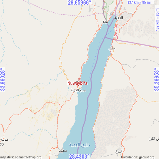
Nuwaybi‘a GPS coordinates[2]
29° 2' 48.516" North, 34° 39' 48.24" East
| Map corner | latitude | longitude |
|---|---|---|
| Upper-left | 29.65966°, | 33.96028° |
| Center: | 29.04681°, | 34.6634° |
| Lower-right: | 28.4303°, | 35.36653° |
| Map W x H: | 136.7×136.7 km | = 84.9×84.9mi |
| max Lat: | 31.5084° ⇑65.2% North |
| Nuwaybi‘a: | 29.04681° |
| min Lat: | ⇓34.8% South 22.3457° |
| min Long | Nuwaybi‘a | max Long |
| 25.51965° | 34.6634° | 34.89572° |
| W 98.6%⇐ | ⇒1.4% E |
Elevation
Elevation of Nuwaybi‘a is 11 m = 36 ft, and this is 32.5 m = 107 ft below average elevation for this country.
| Max E: |
1565 m = 5135 ft | 81.2% |
| Avg. | 43.5 m = 143 ft | |
| Nuwaybi‘a | 11 m = 36 ft | |
Min E: |
-15 m = -49 ft | 18.8% |
See also: Egypt elevation on elevation.city.
Geographical zone
Nuwaybi‘a is located in North temperate zone (between Tropic of Cancer and the Arctic Circle). Distance of this Northern Tropic circle is 623.8 km =387.6 mi to South.| Distance of | km | miles | from Nuwaybi‘a |
|---|---|---|---|
| North Pole | 6777.4 | 4211.3 | to North |
| Arctic Circle | 4171.5 | 2592 | to North |
| Tropic Cancer | 623.8 | 387.6 | to South |
| Equator | 3229.7 | 2006.8 | to South |


Nearby cities:
15 places around Nuwaybi‘a: (largest is in red/bold)
• Ain Sukhna
235.7 km =146.5 mi,  285°
285°
• Arish
246.3 km =153 mi,  340°
340°
• Ash Shaykh Zuwayd
247 km =153.5 mi,  347°
347°
• Dahab
64.9 km =40.3 mi,  194°
194°
• El Gouna
207.6 km =129 mi,  207°
207°
• El-Tor
135.4 km =84.1 mi,  228°
228°
• Hurghada
215.7 km =134 mi,  202°
202°
• Makadi Bay
240.5 km =149.4 mi, 198°
• Rafaḩ
251.9 km =156.5 mi, 350°
• Ras Gharib
172.5 km =107.2 mi,  243°
243°
• Safaga
265.2 km =164.8 mi, 195°
• Saint Catherine
88 km =54.7 mi, 232°
• Sharm el-Sheikh
129.9 km =80.7 mi, 194°
• Suez
231.1 km =143.6 mi,  296°
296°
• Taba
54.4 km =33.8 mi,  24°
24°
Sources, notices
• [Note1] Compared only with cities in Egypt existing in our database
• [Src1] Map data: © OpenStreetMap contributors (CC-BY-SA)
• [Src2] Other city data from geonames.org with taken over terms of usage.
• [Src3] Geographical zone / Annual Mean Temperature by Robert A. Rohde @ Wikipedia
