Safaga geodata
Safaga (Red Sea) is a populated place; located in Egypt in Africa/Cairo (GMT+2) time zone. With population of 32,944 people, there are 116 cities with bigger population in this country. Compared to other cities in Egypt, 85.5% of cities are located further ↑North; 93.5% of cities are located further ←West and 68.1% of cities have higher elevation than Safaga. Note1


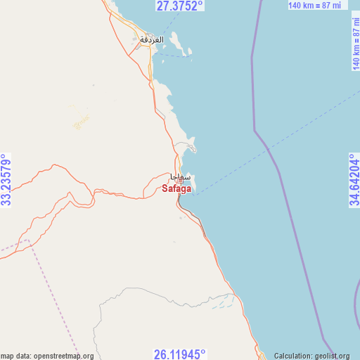
Safaga GPS coordinates[2]
26° 44' 56.616" North, 33° 56' 20.076" East
| Map corner | latitude | longitude |
|---|---|---|
| Upper-left | 27.3752°, | 33.23579° |
| Center: | 26.74906°, | 33.93891° |
| Lower-right: | 26.11945°, | 34.64204° |
| Map W x H: | 139.6×139.6 km | = 86.7×86.7mi |
| max Lat: | 31.5084° ⇑85.5% North |
| Safaga: | 26.74906° |
| min Lat: | ⇓14.5% South 22.3457° |
| min Long | Safaga | max Long |
| 25.51965° | 33.93891° | 34.89572° |
| W 93.5%⇐ | ⇒6.5% E |
Elevation
Elevation of Safaga is 13 m = 43 ft, and this is 30.5 m = 100 ft below average elevation for this country.
| Max E: |
1565 m = 5135 ft | 68.1% |
| Avg. | 43.5 m = 143 ft | |
| Safaga | 13 m = 43 ft | |
Min E: |
-15 m = -49 ft | 31.9% |
See also: Egypt elevation on elevation.city.
Geographical zone
Safaga is located in North temperate zone (between Tropic of Cancer and the Arctic Circle). Distance of this Northern Tropic circle is 368.3 km =228.9 mi to South.| Distance of | km | miles | from Safaga |
|---|---|---|---|
| North Pole | 7032.8 | 4370 | to North |
| Arctic Circle | 4427 | 2750.8 | to North |
| Tropic Cancer | 368.3 | 228.9 | to South |
| Equator | 2974.2 | 1848.1 | to South |


Nearby cities:
15 places around Safaga: (largest is in red/bold)
• Al Balyanā
200.9 km =124.8 mi,  253°
253°
• Al Quşayr
79.2 km =49.2 mi,  154°
154°
• Dahab
200.3 km =124.5 mi,  15°
15°
• Dishnā
161.4 km =100.3 mi,  244°
244°
• El Gouna
76.2 km =47.3 mi,  340°
340°
• El-Tor
168.9 km =104.9 mi,  349°
349°
• Farshūţ
192.9 km =119.9 mi, 246°
• Hurghada
57.9 km =36 mi, 347°
• Kousa
149.4 km =92.8 mi,  231°
231°
• Luxor
174.3 km =108.3 mi, 227°
• Makadi Bay
27.2 km =16.9 mi, 351°
• Naja' Ḥammādī
186.1 km =115.6 mi, 245°
• Qinā
137.1 km =85.2 mi, 241°
• Ras Gharib
198 km =123 mi,  334°
334°
• Sharm el-Sheikh
135.4 km =84.1 mi, 16°
Sources, notices
• [Note1] Compared only with cities in Egypt existing in our database
• [Src1] Map data: © OpenStreetMap contributors (CC-BY-SA)
• [Src2] Other city data from geonames.org with taken over terms of usage.
• [Src3] Geographical zone / Annual Mean Temperature by Robert A. Rohde @ Wikipedia
