Hurghada geodata
Hurghada (Red Sea) is a seat of a first-order administrative division; located in Egypt in Africa/Cairo (GMT+2) time zone. With population of 95,622 people, there are 40 cities with bigger population in this country. Compared to other cities in Egypt, 80.4% of cities are located further ↑North; 92% of cities are located further ←West and 81.2% of cities have higher elevation than Hurghada. Note1


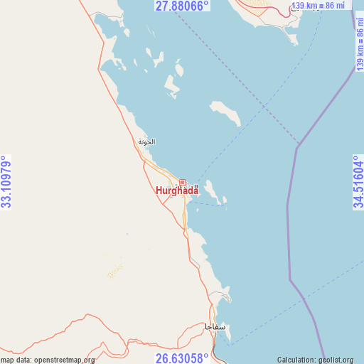
Hurghada GPS coordinates[2]
27° 15' 26.568" North, 33° 48' 46.476" East
| Map corner | latitude | longitude |
|---|---|---|
| Upper-left | 27.88066°, | 33.10979° |
| Center: | 27.25738°, | 33.81291° |
| Lower-right: | 26.63058°, | 34.51604° |
| Map W x H: | 139×139 km | = 86.4×86.4mi |
| max Lat: | 31.5084° ⇑80.4% North |
| Hurghada: | 27.25738° |
| min Lat: | ⇓19.6% South 22.3457° |
| min Long | Hurghada | max Long |
| 25.51965° | 33.81291° | 34.89572° |
| W 92%⇐ | ⇒8% E |
Elevation
Elevation of Hurghada is 11 m = 36 ft, and this is 32.5 m = 107 ft below average elevation for this country.
| Max E: |
1565 m = 5135 ft | 81.2% |
| Avg. | 43.5 m = 143 ft | |
| Hurghada | 11 m = 36 ft | |
Min E: |
-15 m = -49 ft | 18.8% |
See also: Hurghada elevation on elevation.city.
Geographical zone
Hurghada is located in North temperate zone (between Tropic of Cancer and the Arctic Circle). Distance of this Northern Tropic circle is 424.8 km =264 mi to South.| Distance of | km | miles | from Hurghada |
|---|---|---|---|
| North Pole | 6976.3 | 4334.9 | to North |
| Arctic Circle | 4370.4 | 2715.6 | to North |
| Tropic Cancer | 424.8 | 264 | to South |
| Equator | 3030.7 | 1883.2 | to South |


Nearby cities:
15 places around Hurghada: (largest is in red/bold)
• Al Quşayr
136.3 km =84.7 mi,  160°
160°
• Dahab
151.8 km =94.3 mi,  26°
26°
• Dishnā
183 km =113.7 mi,  226°
226°
• El Gouna
20.2 km =12.6 mi,  318°
318°
• El-Tor
111 km =69 mi,  350°
350°
• Farshūţ
211.5 km =131.4 mi, 230°
• Kousa
182.1 km =113.2 mi,  214°
214°
• Luxor
208.8 km =129.7 mi, 213°
• Makadi Bay
30.8 km =19.1 mi, 163°
• Naja' Ḥammādī
206 km =128 mi, 229°
• Qinā
162.5 km =101 mi,  221°
221°
• Ras Gharib
142.1 km =88.3 mi,  329°
329°
• Safaga
57.9 km =36 mi,  167°
167°
• Saint Catherine
145.7 km =90.5 mi,  5°
5°
• Sharm el-Sheikh
89.2 km =55.4 mi, 34°
Sources, notices
• [Note1] Compared only with cities in Egypt existing in our database
• [Src1] Map data: © OpenStreetMap contributors (CC-BY-SA)
• [Src2] Other city data from geonames.org with taken over terms of usage.
• [Src3] Geographical zone / Annual Mean Temperature by Robert A. Rohde @ Wikipedia
