Dosbarrios geodata
Dosbarrios (Castille-La Mancha) is a seat of a third-order administrative division; located in Spain in Europe/Madrid (GMT+2) time zone. With population of 2,223 people, there are 2038 cities with bigger population in this country. Compared to other cities in Spain, 72% of cities are located further ↑North; 51.9% of cities are located further →East and 55.7% of cities have lower elevation than Dosbarrios. Note1
Administrative division(s):
- Level 1: Castille-La Mancha
- Level 2: Province of Toledo
- Level 3: Dosbarrios


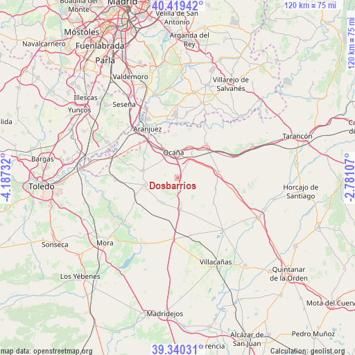
Dosbarrios GPS coordinates[2]
39° 52' 55.164" North, 3° 29' 3.084" West
| Map corner | latitude | longitude |
|---|---|---|
| Upper-left | 40.41942°, | -4.18732° |
| Center: | 39.88199°, | -3.48419° |
| Lower-right: | 39.34031°, | -2.78107° |
| Map W x H: | 120×120 km | = 74.6×74.6mi |
| max Lat: | 43.74134° ⇑72% North |
| Dosbarrios: | 39.88199° |
| min Lat: | ⇓28% South 27.64134° |
| min Long | Dosbarrios | max Long |
| -18.00367° | -3.48419° | 4.2899° |
| W 48.1%⇐ | ⇒51.9% E |
Elevation
Elevation of Dosbarrios is 714 m = 2343 ft, and this is 116 m = 381 ft above average elevation for this country.
| Max E: |
1682 m = 5518 ft | 44.3% |
| Dosbarrios | 714 m 2343 ft | |
| Avg. | 598 m = 1962 ft | |
Min E: |
0 m = 0 ft | 55.7% |
See also: Spain elevation on elevation.city.
Geographical zone
Dosbarrios is located in North temperate zone (between Tropic of Cancer and the Arctic Circle). Distance of this Northern Tropic circle is 1828.5 km =1136.2 mi to South.| Distance of | km | miles | from Dosbarrios |
|---|---|---|---|
| North Pole | 5572.6 | 3462.7 | to North |
| Arctic Circle | 2966.7 | 1843.4 | to North |
| Tropic Cancer | 1828.5 | 1136.2 | to South |
| Equator | 4434.5 | 2755.5 | to South |


Nearby cities:
15 places around Dosbarrios: (largest is in red/bold)
• Aranjuez
19.4 km =12.1 mi,  328°
328°
• Cabañas de Yepes
4.4 km =2.7 mi,  282°
282°
• Ciruelos
12.7 km =7.9 mi,  299°
299°
• Huerta de Valdecarábanos
11.2 km =7 mi,  259°
259°
• La Guardia
10.5 km =6.5 mi,  176°
176°
• Noblejas
11.6 km =7.2 mi,  18°
18°
• Ocaña
8.5 km =5.3 mi,  351°
351°
• Ontígola
15.5 km =9.6 mi, 331°
• Romeral
19.9 km =12.4 mi,  167°
167°
• Tembleque
20.8 km =12.9 mi, 184°
• Villamuelas
22.5 km =14 mi,  251°
251°
• Villarrubia de Santiago
15.1 km =9.4 mi,  40°
40°
• Villasequilla de Yepes
21.1 km =13.1 mi,  268°
268°
• Villatobas
13.9 km =8.6 mi,  80°
80°
• Yepes
12.2 km =7.6 mi, 280°
Sources, notices
• [Note1] Compared only with cities in Spain existing in our database
• [Src1] Map data: © OpenStreetMap contributors (CC-BY-SA)
• [Src2] Other city data from geonames.org with taken over terms of usage.
• [Src3] Geographical zone / Annual Mean Temperature by Robert A. Rohde @ Wikipedia
