Shama Junction geodata
Shama Junction (Western) is a populated place; located in Ghana in Africa/Accra (GMT+0) time zone. With population of 20,946 people, there are 53 cities with bigger population in this country. Compared to other cities in Ghana, 95.8% of cities are located further ↑North; 73.6% of cities are located further →East and 94.4% of cities have higher elevation than Shama Junction. Note1


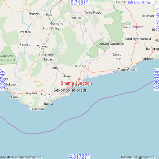
Shama Junction GPS coordinates[2]
5° 1' 5.016" North, 1° 39' 51.732" West
| Map corner | latitude | longitude |
|---|---|---|
| Upper-left | 5.7181°, | -2.36749° |
| Center: | 5.01806°, | -1.66437° |
| Lower-right: | 4.31727°, | -0.96124° |
| Map W x H: | 155.8×155.8 km | = 96.8×96.8mi |
| max Lat: | 11.0616° ⇑95.8% North |
| Shama Junction: | 5.01806° |
| min Lat: | ⇓4.2% South 4.86641° |
| min Long | Shama Junction | max Long |
| -2.78516° | -1.66437° | 1.19012° |
| W 26.4%⇐ | ⇒73.6% E |
Elevation
Elevation of Shama Junction is 12 m = 39 ft, and this is 158.2 m = 519 ft below average elevation for this country.
| Max E: |
477 m = 1565 ft | 94.4% |
| Avg. | 170.2 m = 558 ft | |
| Shama Junction | 12 m = 39 ft | |
Min E: |
0 m = 0 ft | 5.6% |
See also: Ghana elevation on elevation.city.
Geographical zone
Shama Junction is located in North Torrid zone (between Equator and Tropic of Cancer). Distance of Equator is 558 km =346.7 mi to South.| Distance of | km | miles | from Shama Junction |
|---|---|---|---|
| North Pole | 9449.1 | 5871.4 | to North |
| Arctic Circle | 6843.2 | 4252.2 | to North |
| Tropic Cancer | 2048 | 1272.6 | to North |
| Equator | 558 | 346.7 | to South |


Nearby cities:
15 places around Shama Junction: (largest is in red/bold)
• Aboso
49.4 km =30.7 mi,  320°
320°
• Akim Swedru
120.9 km =75.1 mi,  36°
36°
• Apam
106.9 km =66.4 mi,  73°
73°
• Axim
66.2 km =41.1 mi,  255°
255°
• Cape Coast
47.3 km =29.4 mi,  78°
78°
• Dunkwa
105.5 km =65.6 mi,  353°
353°
• Elmina
35.5 km =22.1 mi, 77°
• Foso
86.7 km =53.9 mi,  28°
28°
• Mumford
103.9 km =64.6 mi, 74°
• Prestea
70.3 km =43.7 mi,  311°
311°
• Saltpond
70.2 km =43.6 mi, 72°
• Sekondi-Takoradi
14.5 km =9 mi,  225°
225°
• Takoradi
17 km =10.6 mi,  218°
218°
• Tarkwa
48 km =29.8 mi, 311°
• Wassa-Akropong
97.3 km =60.5 mi,  331°
331°
Sources, notices
• [Note1] Compared only with cities in Ghana existing in our database
• [Src1] Map data: © OpenStreetMap contributors (CC-BY-SA)
• [Src2] Other city data from geonames.org with taken over terms of usage.
• [Src3] Geographical zone / Annual Mean Temperature by Robert A. Rohde @ Wikipedia
