Macenta geodata
Macenta (Nzerekore) is a seat of a second-order administrative division; located in Guinea in Africa/Conakry (GMT+0) time zone. With population of 43,102 people, there are 11 cities with bigger population in this country. Compared to other cities in Guinea, 92.3% of cities are located further ↑North; 79.5% of cities are located further ←West and 71.8% of cities have lower elevation than Macenta. Note1


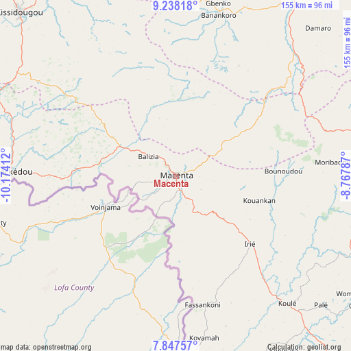
Macenta GPS coordinates[2]
8° 32' 36.636" North, 9° 28' 15.564" West
| Map corner | latitude | longitude |
|---|---|---|
| Upper-left | 9.23818°, | -10.17412° |
| Center: | 8.54351°, | -9.47099° |
| Lower-right: | 7.84757°, | -8.76787° |
| Map W x H: | 154.6×154.6 km | = 96.1×96.1mi |
| max Lat: | 12.5311° ⇑92.3% North |
| Macenta: | 8.54351° |
| min Lat: | ⇓7.7% South 7.56748° |
| min Long | Macenta | max Long |
| -14.36667° | -9.47099° | -8.53333° |
| W 79.5%⇐ | ⇒20.5% E |
Elevation
Elevation of Macenta is 546 m = 1791 ft, and this is 112.6 m = 369 ft above average elevation for this country.
| Max E: |
1440 m = 4724 ft | 28.2% |
| Macenta | 546 m 1791 ft | |
| Avg. | 433.4 m = 1422 ft | |
Min E: |
0 m = 0 ft | 71.8% |
See also: Macenta elevation on elevation.city.
Geographical zone
Macenta is located in North Torrid zone (between Equator and Tropic of Cancer). Distance of Equator is 949.9 km =590.2 mi to South.| Distance of | km | miles | from Macenta |
|---|---|---|---|
| North Pole | 9057.1 | 5627.8 | to North |
| Arctic Circle | 6451.2 | 4008.6 | to North |
| Tropic Cancer | 1656 | 1029 | to North |
| Equator | 949.9 | 590.2 | to South |


Nearby cities:
15 places around Macenta: (largest is in red/bold)
• Beyla
91.9 km =57.1 mi,  79°
79°
• Dabola
303.3 km =188.5 mi,  323°
323°
• Dinguiraye
334.3 km =207.7 mi,  336°
336°
• Faranah
217.2 km =135 mi, 320°
• Gueckedou
72.9 km =45.3 mi,  272°
272°
• Kankan
205.6 km =127.8 mi,  5°
5°
• Kissidougou
99.3 km =61.7 mi, 315°
• Kouroussa
238.5 km =148.2 mi,  349°
349°
• Kérouané
94.6 km =58.8 mi,  31°
31°
• Lola
132.2 km =82.1 mi,  128°
128°
• Mandiana
246.7 km =153.3 mi,  20°
20°
• Nzérékoré
113.3 km =70.4 mi,  140°
140°
• Siguiri
321.9 km =200 mi, 5°
• Tokonou
127.7 km =79.3 mi, 344°
• Yomou
110.9 km =68.9 mi,  168°
168°
Sources, notices
• [Note1] Compared only with cities in Guinea existing in our database
• [Src1] Map data: © OpenStreetMap contributors (CC-BY-SA)
• [Src2] Other city data from geonames.org with taken over terms of usage.
• [Src3] Geographical zone / Annual Mean Temperature by Robert A. Rohde @ Wikipedia
