Faranah geodata
Faranah is a seat of a first-order administrative division; located in Guinea in Africa/Conakry (GMT+0) time zone. With population of 9,350 people, there are 26 cities with bigger population in this country. Compared to other cities in Guinea, 64.1% of cities are located further ↑North; 64.1% of cities are located further ←West and 56.4% of cities have lower elevation than Faranah. Note1


Faranah GPS coordinates[2]
10° 2' 25.296" North, 10° 44' 36.348" West
| Map corner | latitude | longitude |
|---|---|---|
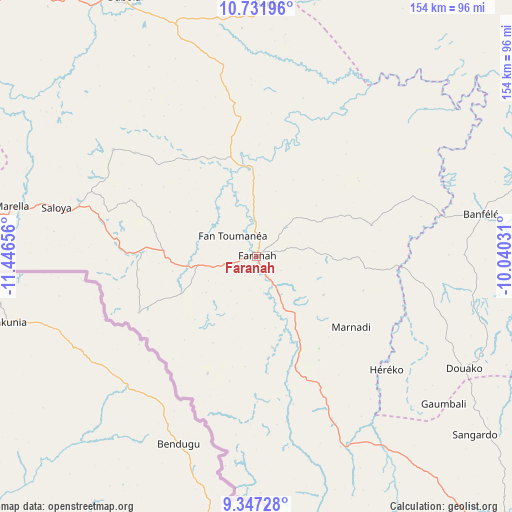
| Upper-left | 10.73196°, | -11.44656° |
| Center: | 10.04036°, | -10.74343° |
| Lower-right: | 9.34728°, | -10.04031° |
| Map W x H: | 154×154 km | = 95.7×95.7mi |
| max Lat: | 12.5311° ⇑64.1% North |
| Faranah: | 10.04036° |
| min Lat: | ⇓35.9% South 7.56748° |
| min Long | Faranah | max Long |
| -14.36667° | -10.74343° | -8.53333° |
| W 64.1%⇐ | ⇒35.9% E |
Elevation
Elevation of Faranah is 433 m = 1421 ft, and this is 0.39999999999998 m = 1 ft below average elevation for this country.
| Max E: |
1440 m = 4724 ft | 43.6% |
| Avg. | 433.4 m = 1422 ft | |
| Faranah | 433 m = 1421 ft | |
Min E: |
0 m = 0 ft | 56.4% |
See also: Guinea elevation on elevation.city.
Geographical zone
Faranah is located in North Torrid zone (between Equator and Tropic of Cancer). Distance of Equator is 1116.4 km =693.7 mi to South.| Distance of | km | miles | from Faranah |
|---|---|---|---|
| North Pole | 8890.7 | 5524.4 | to North |
| Arctic Circle | 6284.8 | 3905.2 | to North |
| Tropic Cancer | 1489.5 | 925.5 | to North |
| Equator | 1116.4 | 693.7 | to South |


Nearby cities:
15 places around Faranah: (largest is in red/bold)
• Dabola
87.7 km =54.5 mi,  332°
332°
• Dalaba
180 km =111.8 mi,  293°
293°
• Dinguiraye
139.1 km =86.4 mi,  1°
1°
• Gueckedou
176.9 km =109.9 mi,  157°
157°
• Kankan
161.9 km =100.6 mi,  76°
76°
• Kissidougou
118.4 km =73.6 mi,  143°
143°
• Koubia
213 km =132.4 mi,  323°
323°
• Kouroussa
116 km =72.1 mi,  54°
54°
• Kérouané
207.9 km =129.2 mi,  114°
114°
• Labé
220.2 km =136.8 mi,  310°
310°
• Macenta
217.2 km =135 mi, 140°
• Mamou
152.1 km =94.5 mi,  284°
284°
• Pita
213.1 km =132.4 mi,  302°
302°
• Tokonou
113.8 km =70.7 mi, 112°
• Tougué
185.8 km =115.5 mi, 327°
Sources, notices
• [Note1] Compared only with cities in Guinea existing in our database
• [Src1] Map data: © OpenStreetMap contributors (CC-BY-SA)
• [Src2] Other city data from geonames.org with taken over terms of usage.
• [Src3] Geographical zone / Annual Mean Temperature by Robert A. Rohde @ Wikipedia
