Beyla geodata
Beyla (Nzerekore) is a seat of a second-order administrative division; located in Guinea in Africa/Conakry (GMT+0) time zone. With population of 11,566 people, there are 22 cities with bigger population in this country. Compared to other cities in Guinea, 87.2% of cities are located further ↑North; 97.4% of cities are located further ←West and 79.5% of cities have lower elevation than Beyla. Note1


Beyla GPS coordinates[2]
8° 41' 24.396" North, 8° 38' 55.284" West
| Map corner | latitude | longitude |
|---|---|---|
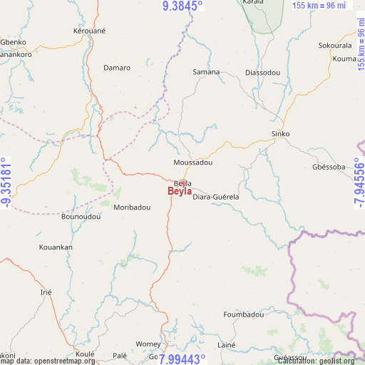
| Upper-left | 9.3845°, | -9.35181° |
| Center: | 8.69011°, | -8.64869° |
| Lower-right: | 7.99443°, | -7.94556° |
| Map W x H: | 154.6×154.6 km | = 96.1×96.1mi |
| max Lat: | 12.5311° ⇑87.2% North |
| Beyla: | 8.69011° |
| min Lat: | ⇓12.8% South 7.56748° |
| min Long | Beyla | max Long |
| -14.36667° | -8.64869° | -8.53333° |
| W 97.4%⇐ | ⇒2.6% E |
Elevation
Elevation of Beyla is 684 m = 2244 ft, and this is 250.6 m = 822 ft above average elevation for this country.
| Max E: |
1440 m = 4724 ft | 20.5% |
| Beyla | 684 m 2244 ft | |
| Avg. | 433.4 m = 1422 ft | |
Min E: |
0 m = 0 ft | 79.5% |
See also: Guinea elevation on elevation.city.
Geographical zone
Beyla is located in North Torrid zone (between Equator and Tropic of Cancer). Distance of Equator is 966.2 km =600.4 mi to South.| Distance of | km | miles | from Beyla |
|---|---|---|---|
| North Pole | 9040.8 | 5617.7 | to North |
| Arctic Circle | 6434.9 | 3998.5 | to North |
| Tropic Cancer | 1639.7 | 1018.9 | to North |
| Equator | 966.2 | 600.4 | to South |


Nearby cities:
15 places around Beyla: (largest is in red/bold)
• Dabola
353.2 km =219.5 mi,  310°
310°
• Dinguiraye
366.9 km =228 mi,  321°
321°
• Faranah
274.5 km =170.6 mi,  303°
303°
• Gueckedou
163.8 km =101.8 mi,  265°
265°
• Kankan
201.8 km =125.4 mi,  339°
339°
• Kissidougou
168.6 km =104.8 mi,  289°
289°
• Kouroussa
256.5 km =159.4 mi,  328°
328°
• Kérouané
75.8 km =47.1 mi, 327°
• Lola
99.8 km =62 mi,  172°
172°
• Macenta
91.9 km =57.1 mi,  259°
259°
• Mandiana
215.3 km =133.8 mi,  358°
358°
• Nzérékoré
105.5 km =65.6 mi,  190°
190°
• Siguiri
309.1 km =192.1 mi,  349°
349°
• Tokonou
164 km =101.9 mi, 310°
• Yomou
142 km =88.2 mi,  208°
208°
Sources, notices
• [Note1] Compared only with cities in Guinea existing in our database
• [Src1] Map data: © OpenStreetMap contributors (CC-BY-SA)
• [Src2] Other city data from geonames.org with taken over terms of usage.
• [Src3] Geographical zone / Annual Mean Temperature by Robert A. Rohde @ Wikipedia
