Kimbo geodata
Kimbo (Boke) is a populated place; located in Guinea in Africa/Conakry (GMT+0) time zone. With population of 9,326 people, there are 27 cities with bigger population in this country. Compared to other cities in Guinea, 53.8% of cities are located further ↓South; 84.6% of cities are located further →East and 66.7% of cities have higher elevation than Kimbo. Note1


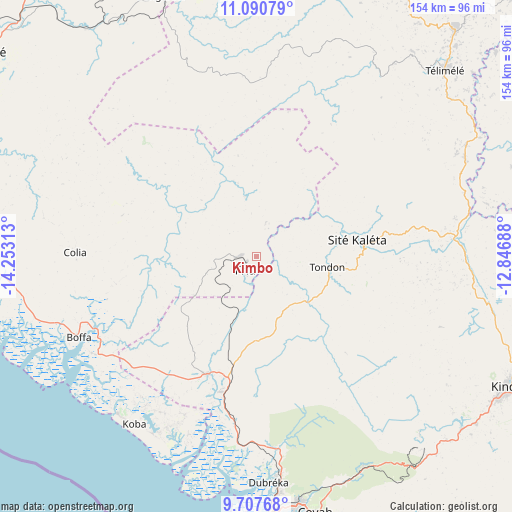
Kimbo GPS coordinates[2]
10° 24' 0" North, 13° 33' 0" West
| Map corner | latitude | longitude |
|---|---|---|
| Upper-left | 11.09079°, | -14.25313° |
| Center: | 10.4°, | -13.55° |
| Lower-right: | 9.70768°, | -12.84688° |
| Map W x H: | 153.8×153.8 km | = 95.6×95.6mi |
| max Lat: | 12.5311° ⇑46.2% North |
| Kimbo: | 10.4° |
| min Lat: | ⇓53.8% South 7.56748° |
| min Long | Kimbo | max Long |
| -14.36667° | -13.55° | -8.53333° |
| W 15.4%⇐ | ⇒84.6% E |
Elevation
Elevation of Kimbo is 262 m = 860 ft, and this is 171.4 m = 562 ft below average elevation for this country.
| Max E: |
1440 m = 4724 ft | 66.7% |
| Avg. | 433.4 m = 1422 ft | |
| Kimbo | 262 m = 860 ft | |
Min E: |
0 m = 0 ft | 33.3% |
See also: Guinea elevation on elevation.city.
Geographical zone
Kimbo is located in North Torrid zone (between Equator and Tropic of Cancer). Distance of Equator is 1156.4 km =718.6 mi to South.| Distance of | km | miles | from Kimbo |
|---|---|---|---|
| North Pole | 8850.7 | 5499.6 | to North |
| Arctic Circle | 6244.8 | 3880.3 | to North |
| Tropic Cancer | 1449.5 | 900.7 | to North |
| Equator | 1156.4 | 718.6 | to South |


Nearby cities:
15 places around Kimbo: (largest is in red/bold)
• Boffa
58.9 km =36.6 mi,  243°
243°
• Boké
100.2 km =62.3 mi,  306°
306°
• Camayenne
97.4 km =60.5 mi,  188°
188°
• Conakry
96.9 km =60.2 mi, 188°
• Coyah
79.2 km =49.2 mi,  166°
166°
• Dalaba
145.8 km =90.6 mi,  77°
77°
• Dubréka
67.8 km =42.1 mi,  177°
177°
• Forécariah
119.1 km =74 mi,  154°
154°
• Fria
5.1 km =3.2 mi,  223°
223°
• Kindia
84 km =52.2 mi,  116°
116°
• Lélouma
148.1 km =92 mi,  39°
39°
• Pita
145.9 km =90.7 mi,  59°
59°
• Sanguéya
95.3 km =59.2 mi,  290°
290°
• Tondon
22.2 km =13.8 mi,  99°
99°
• Télimélé
79.2 km =49.2 mi,  45°
45°
Sources, notices
• [Note1] Compared only with cities in Guinea existing in our database
• [Src1] Map data: © OpenStreetMap contributors (CC-BY-SA)
• [Src2] Other city data from geonames.org with taken over terms of usage.
• [Src3] Geographical zone / Annual Mean Temperature by Robert A. Rohde @ Wikipedia
