Dayapar geodata
Dayapar (Gujarat) is a farm village; located in India in Asia/Kolkata (GMT+5.5) time zone. With population of 12,000 people, there are 2740 cities with bigger population in this country. Compared to other cities in India, 55.6% of cities are located further ↓South; 100% of cities are located further →East and 67.9% of cities have higher elevation than Dayapar. Note1


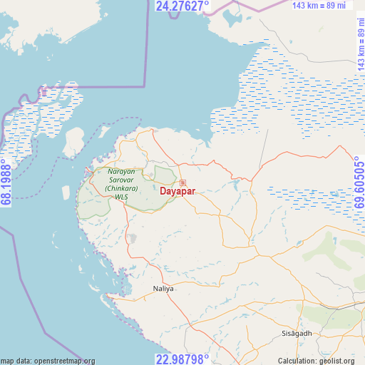
Dayapar GPS coordinates[2]
23° 38' 1.356" North, 68° 54' 6.912" East
| Map corner | latitude | longitude |
|---|---|---|
| Upper-left | 24.27627°, | 68.1988° |
| Center: | 23.63371°, | 68.90192° |
| Lower-right: | 22.98798°, | 69.60505° |
| Map W x H: | 143.2×143.2 km | = 89×89mi |
| max Lat: | 34.9274° ⇑44.4% North |
| Dayapar: | 23.63371° |
| min Lat: | ⇓55.6% South 8.09008° |
| min Long | Dayapar | max Long |
| 68.82655° | 68.90192° | 96.81° |
| W 0%⇐ | ⇒100% E |
Elevation
Elevation of Dayapar is 103 m = 338 ft, and this is 192.6 m = 632 ft below average elevation for this country.
| Max E: |
3681 m = 12077 ft | 67.9% |
| Avg. | 295.6 m = 970 ft | |
| Dayapar | 103 m = 338 ft | |
Min E: |
1 m = 3 ft | 32.1% |
See also: India elevation on elevation.city.
Geographical zone
Dayapar is located in North temperate zone (between Tropic of Cancer and the Arctic Circle). Distance of this Northern Tropic circle is 21.9 km =13.6 mi to South.| Distance of | km | miles | from Dayapar |
|---|---|---|---|
| North Pole | 7379.2 | 4585.2 | to North |
| Arctic Circle | 4773.4 | 2966.1 | to North |
| Tropic Cancer | 21.9 | 13.6 | to South |
| Equator | 2627.8 | 1632.8 | to South |


Nearby cities:
15 places around Dayapar: (largest is in red/bold)
• Anjār
128.6 km =79.9 mi,  116°
116°
• Bedi
171.7 km =106.7 mi,  137°
137°
• Bhachāu
151.6 km =94.2 mi,  104°
104°
• Bhuj
88.9 km =55.2 mi, 118°
• Dwārka
155.2 km =96.4 mi,  177°
177°
• Gāndhīdhām
139.8 km =86.9 mi, 115°
• Jodiya Bandar
174.2 km =108.2 mi,  125°
125°
• Kāndla
149.9 km =93.1 mi, 116°
• Mundra
121.8 km =75.7 mi, 136°
• Māndvi
100.2 km =62.3 mi,  152°
152°
• Naliya
42.2 km =26.2 mi,  190°
190°
• Okha
130.8 km =81.3 mi,  172°
172°
• Roha
61.5 km =38.2 mi, 142°
• Salāya
163.7 km =101.7 mi, 153°
• Sikka
164.6 km =102.3 mi, 144°
Sources, notices
• [Note1] Compared only with cities in India existing in our database
• [Src1] Map data: © OpenStreetMap contributors (CC-BY-SA)
• [Src2] Other city data from geonames.org with taken over terms of usage.
• [Src3] Geographical zone / Annual Mean Temperature by Robert A. Rohde @ Wikipedia
