Bhandāra geodata
Bhandāra (Maharashtra) is a populated place; located in India in Asia/Kolkata (GMT+5.5) time zone. With population of 90,183 people, there are 493 cities with bigger population in this country. Compared to other cities in India, 60.9% of cities are located further ↑North; 65.2% of cities are located further ←West and 61.5% of cities have lower elevation than Bhandāra. Note1


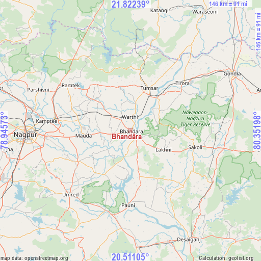
Bhandāra GPS coordinates[2]
21° 10' 5.412" North, 79° 38' 55.86" East
| Map corner | latitude | longitude |
|---|---|---|
| Upper-left | 21.82239°, | 78.94573° |
| Center: | 21.16817°, | 79.64885° |
| Lower-right: | 20.51105°, | 80.35198° |
| Map W x H: | 145.8×145.8 km | = 90.6×90.6mi |
| max Lat: | 34.9274° ⇑60.9% North |
| Bhandāra: | 21.16817° |
| min Lat: | ⇓39.1% South 8.09008° |
| min Long | Bhandāra | max Long |
| 68.82655° | 79.64885° | 96.81° |
| W 65.2%⇐ | ⇒34.8% E |
Elevation
Elevation of Bhandāra is 262 m = 860 ft, and this is 33.6 m = 110 ft below average elevation for this country.
| Max E: |
3681 m = 12077 ft | 38.5% |
| Avg. | 295.6 m = 970 ft | |
| Bhandāra | 262 m = 860 ft | |
Min E: |
1 m = 3 ft | 61.5% |
See also: Bhandāra elevation on elevation.city.
Geographical zone
Bhandāra is located in North Torrid zone (between Equator and Tropic of Cancer). Distance of this Northern Tropic circle is 252.2 km =156.7 mi to North.| Distance of | km | miles | from Bhandāra |
|---|---|---|---|
| North Pole | 7653.4 | 4755.6 | to North |
| Arctic Circle | 5047.5 | 3136.4 | to North |
| Tropic Cancer | 252.2 | 156.7 | to North |
| Equator | 2353.7 | 1462.5 | to South |


Nearby cities:
15 places around Bhandāra: (largest is in red/bold)
• Chicholi
33.9 km =21.1 mi,  9°
9°
• Gondiā
65 km =40.4 mi,  60°
60°
• Hīrāpur Hamesha
45.3 km =28.1 mi,  18°
18°
• Katangi
69.2 km =43 mi, 13°
• Khāpa
74.7 km =46.4 mi,  292°
292°
• Korādi
57 km =35.4 mi,  278°
278°
• Kāmthi
47.1 km =29.3 mi, 276°
• Kāndri
47.7 km =29.6 mi,  306°
306°
• Mansar
47.3 km =29.4 mi,  302°
302°
• Nagpur
58.5 km =36.4 mi,  267°
267°
• Pawni
41.8 km =26 mi,  181°
181°
• Rāmtek
41.8 km =26 mi, 307°
• Tirodi
57.9 km =36 mi, 7°
• Tumsar
25.5 km =15.8 mi, 20°
• Umred
48.5 km =30.1 mi,  223°
223°
Sources, notices
• [Note1] Compared only with cities in India existing in our database
• [Src1] Map data: © OpenStreetMap contributors (CC-BY-SA)
• [Src2] Other city data from geonames.org with taken over terms of usage.
• [Src3] Geographical zone / Annual Mean Temperature by Robert A. Rohde @ Wikipedia
