Sultānpur geodata
Sultānpur (Madhya Pradesh) is a populated place; located in India in Asia/Kolkata (GMT+5.5) time zone. With population of 9,419 people, there are 3001 cities with bigger population in this country. Compared to other cities in India, 52.5% of cities are located further ↓South; 52% of cities are located further →East and 73.6% of cities have lower elevation than Sultānpur. Note1


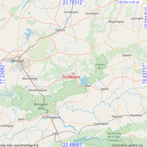
Sultānpur GPS coordinates[2]
23° 8' 17.232" North, 77° 56' 2.544" East
| Map corner | latitude | longitude |
|---|---|---|
| Upper-left | 23.78312°, | 77.23092° |
| Center: | 23.13812°, | 77.93404° |
| Lower-right: | 22.49001°, | 78.63717° |
| Map W x H: | 143.8×143.8 km | = 89.4×89.4mi |
| max Lat: | 34.9274° ⇑47.5% North |
| Sultānpur: | 23.13812° |
| min Lat: | ⇓52.5% South 8.09008° |
| min Long | Sultānpur | max Long |
| 68.82655° | 77.93404° | 96.81° |
| W 48%⇐ | ⇒52% E |
Elevation
Elevation of Sultānpur is 368 m = 1207 ft, and this is 72.4 m = 238 ft above average elevation for this country.
| Max E: |
3681 m = 12077 ft | 26.4% |
| Sultānpur | 368 m 1207 ft | |
| Avg. | 295.6 m = 970 ft | |
Min E: |
1 m = 3 ft | 73.6% |
See also: India elevation on elevation.city.
Geographical zone
Sultānpur is located in North Torrid zone (between Equator and Tropic of Cancer). Distance of this Northern Tropic circle is 33.2 km =20.6 mi to North.| Distance of | km | miles | from Sultānpur |
|---|---|---|---|
| North Pole | 7434.3 | 4619.5 | to North |
| Arctic Circle | 4828.5 | 3000.3 | to North |
| Tropic Cancer | 33.2 | 20.6 | to North |
| Equator | 2572.7 | 1598.6 | to South |


Nearby cities:
15 places around Sultānpur: (largest is in red/bold)
• Begamganj
66 km =41 mi,  38°
38°
• Berasia
74.9 km =46.5 mi,  317°
317°
• Bhopal
55.8 km =34.7 mi,  283°
283°
• Bābai
48.4 km =30.1 mi,  179°
179°
• Bāsoda
79.3 km =49.3 mi,  0°
0°
• Hoshangābād
48.3 km =30 mi,  205°
205°
• Itārsi
60.8 km =37.8 mi,  196°
196°
• Jaithāri
70 km =43.5 mi,  83°
83°
• Mandideep
41.5 km =25.8 mi,  261°
261°
• Raisen
26.5 km =16.5 mi, 323°
• Rehti
67.8 km =42.1 mi,  229°
229°
• Sohāgpur
55.5 km =34.5 mi,  151°
151°
• Sānchi
43.6 km =27.1 mi,  332°
332°
• Udaipura
59.4 km =36.9 mi,  96°
96°
• Vidisha
44.9 km =27.9 mi,  343°
343°
Sources, notices
• [Note1] Compared only with cities in India existing in our database
• [Src1] Map data: © OpenStreetMap contributors (CC-BY-SA)
• [Src2] Other city data from geonames.org with taken over terms of usage.
• [Src3] Geographical zone / Annual Mean Temperature by Robert A. Rohde @ Wikipedia
