Sītāmarhi geodata
Sītāmarhi (Bihar) is a populated place; located in India in Asia/Kolkata (GMT+5.5) time zone. With population of 57,095 people, there are 775 cities with bigger population in this country. Compared to other cities in India, 75.4% of cities are located further ↓South; 85.5% of cities are located further ←West and 74.6% of cities have higher elevation than Sītāmarhi. Note1


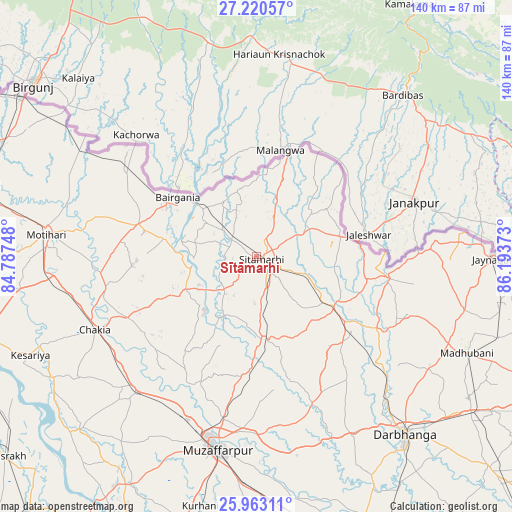
Sītāmarhi GPS coordinates[2]
26° 35' 36.852" North, 85° 29' 26.16" East
| Map corner | latitude | longitude |
|---|---|---|
| Upper-left | 27.22057°, | 84.78748° |
| Center: | 26.59357°, | 85.4906° |
| Lower-right: | 25.96311°, | 86.19373° |
| Map W x H: | 139.8×139.8 km | = 86.9×86.9mi |
| max Lat: | 34.9274° ⇑24.6% North |
| Sītāmarhi: | 26.59357° |
| min Lat: | ⇓75.4% South 8.09008° |
| min Long | Sītāmarhi | max Long |
| 68.82655° | 85.4906° | 96.81° |
| W 85.5%⇐ | ⇒14.5% E |
Elevation
Elevation of Sītāmarhi is 70 m = 230 ft, and this is 225.6 m = 740 ft below average elevation for this country.
| Max E: |
3681 m = 12077 ft | 74.6% |
| Avg. | 295.6 m = 970 ft | |
| Sītāmarhi | 70 m = 230 ft | |
Min E: |
1 m = 3 ft | 25.4% |
See also: Sītāmarhi elevation on elevation.city.
Geographical zone
Sītāmarhi is located in North temperate zone (between Tropic of Cancer and the Arctic Circle). Distance of this Northern Tropic circle is 351 km =218.1 mi to South.| Distance of | km | miles | from Sītāmarhi |
|---|---|---|---|
| North Pole | 7050.1 | 4380.7 | to North |
| Arctic Circle | 4444.2 | 2761.5 | to North |
| Tropic Cancer | 351 | 218.1 | to South |
| Equator | 2956.9 | 1837.3 | to South |


Nearby cities:
15 places around Sītāmarhi: (largest is in red/bold)
• Bairāgnia
27.1 km =16.8 mi,  307°
307°
• Belsand
18.9 km =11.7 mi,  208°
208°
• Bhagirathpur
67.5 km =41.9 mi,  122°
122°
• Chākia
48.4 km =30.1 mi,  245°
245°
• Darbhanga
63.6 km =39.5 mi,  140°
140°
• Dhāka
33.4 km =20.8 mi,  285°
285°
• Dumra
4.2 km =2.6 mi,  134°
134°
• Jaynagar
64.4 km =40 mi,  90°
90°
• Madhubani
63.7 km =39.6 mi,  114°
114°
• Mothīhāri
57.4 km =35.7 mi,  276°
276°
• Muzaffarpur
53.3 km =33.1 mi,  190°
190°
• Pupri
25.2 km =15.7 mi, 122°
• Raxaul
76.7 km =47.7 mi,  304°
304°
• Sagauli
76.6 km =47.6 mi, 284°
• Sheohar
21.5 km =13.4 mi, 245°
Sources, notices
• [Note1] Compared only with cities in India existing in our database
• [Src1] Map data: © OpenStreetMap contributors (CC-BY-SA)
• [Src2] Other city data from geonames.org with taken over terms of usage.
• [Src3] Geographical zone / Annual Mean Temperature by Robert A. Rohde @ Wikipedia
